MyTopo
Pollywog Lake Utah US Topo Map
Couldn't load pickup availability
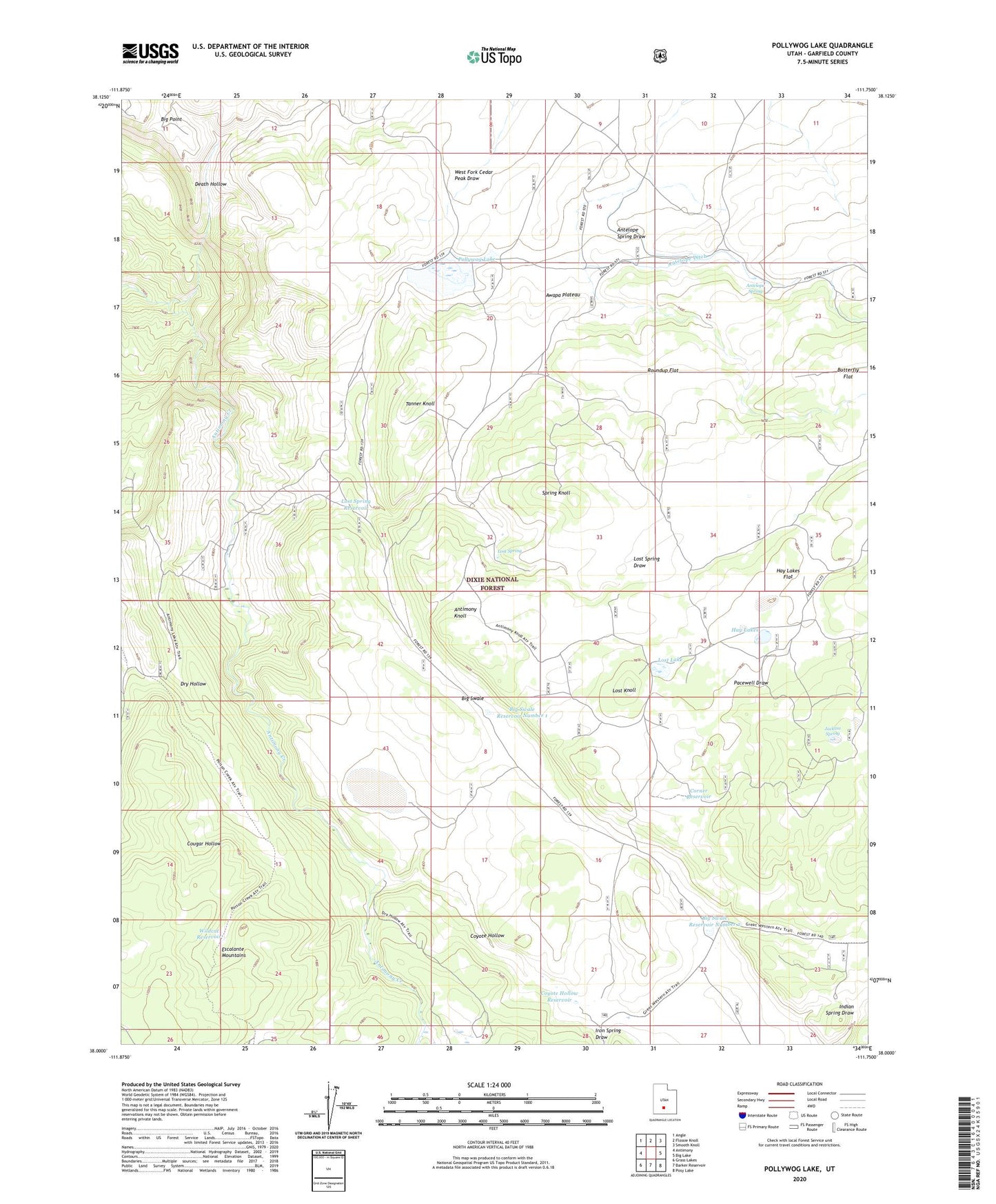
2020 topographic map quadrangle Pollywog Lake in the state of Utah. Scale: 1:24000. Based on the newly updated USGS 7.5' US Topo map series, this map is in the following counties: Garfield. The map contains contour data, water features, and other items you are used to seeing on USGS maps, but also has updated roads and other features. This is the next generation of topographic maps. Printed on high-quality waterproof paper with UV fade-resistant inks.
Quads adjacent to this one:
West: Antimony
Northwest: Angle
North: Flossie Knoll
Northeast: Smooth Knoll
East: Big Lake
Southeast: Posy Lake
South: Barker Reservoir
Southwest: Grass Lakes
Contains the following named places: Antelope Ditch, Antelope Spring, Antimony Knoll, Big Swale, Big Swale Reservoir Number 1, Big Swale Reservoir Number 2, Corner Reservoir, Cougar Hollow, Coyote Hollow, Coyote Hollow Reservoir, Death Hollow, Dry Hollow, Dry Lake, Hay Lakes, Hay Lakes Flat, Iron Spring Draw, Jackass Spring, Lost Knoll, Lost Lake, Lost Spring, Lost Spring Draw, Lost Spring Knoll, Lost Spring Reservoir, Pacewell Draw, Pollywog Lake, Pollywog Lake Dam, Roundup Flat, Tanner Knoll, Wildcat Reservoir