MyTopo
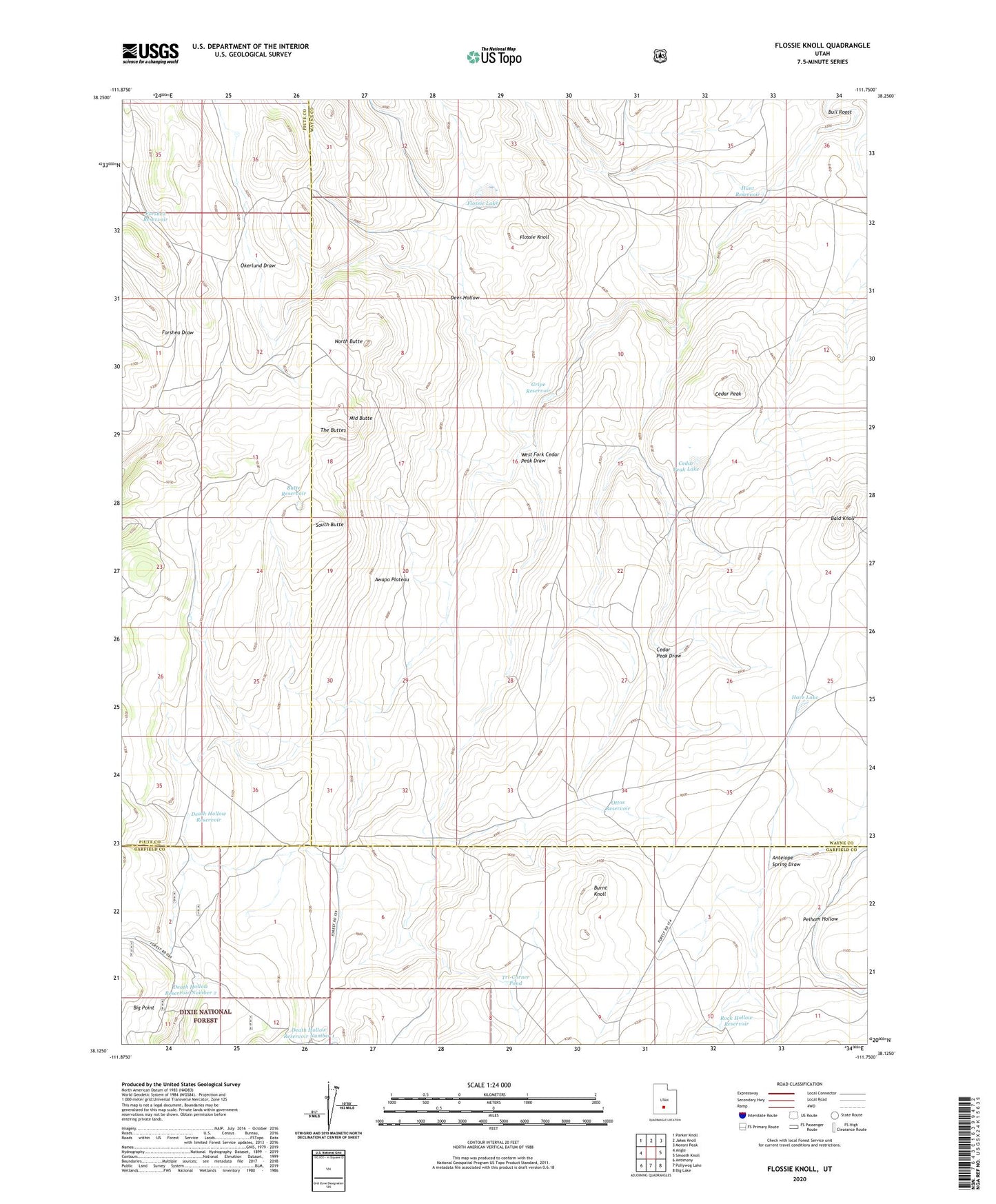
Flossie Knoll Utah US Topo Map
Couldn't load pickup availability
Also explore the Flossie Knoll Forest Service Topo of this same quad for updated USFS data
2023 topographic map quadrangle Flossie Knoll in the state of Utah. Scale: 1:24000. Based on the newly updated USGS 7.5' US Topo map series, this map is in the following counties: Wayne, Garfield, Piute. The map contains contour data, water features, and other items you are used to seeing on USGS maps, but also has updated roads and other features. This is the next generation of topographic maps. Printed on high-quality waterproof paper with UV fade-resistant inks.
Quads adjacent to this one:
West: Angle
Northwest: Parker Knoll
North: Jakes Knoll
Northeast: Moroni Peak
East: Smooth Knoll
Southeast: Big Lake
South: Pollywog Lake
Southwest: Antimony
This map covers the same area as the classic USGS quad with code o38111b7.
Contains the following named places: Awapa Plateau, Bald Knoll, Burnt Knoll, Butte Reservoir, Cedar Peak, Cedar Peak Lake, Death Hollow Reservoir, Death Hollow Reservoir Number 1, Death Hollow Reservoir Number 2, Deer Hollow, Flossie Knoll, Flossie Lake, Forshea Draw, Forshea Reservoir, Gripe Reservoir, Hare Lake, Hunt Reservoir, Middle Butte, North Butte, Okerlund Draw, Ottos Reservoir, Rock Hollow Reservoir, South Butte, The Buttes, The Tanks, Tri-Corner Pond, West Fork Cedar Peak Draw