MyTopo
Red Point Utah US Topo Map
Couldn't load pickup availability
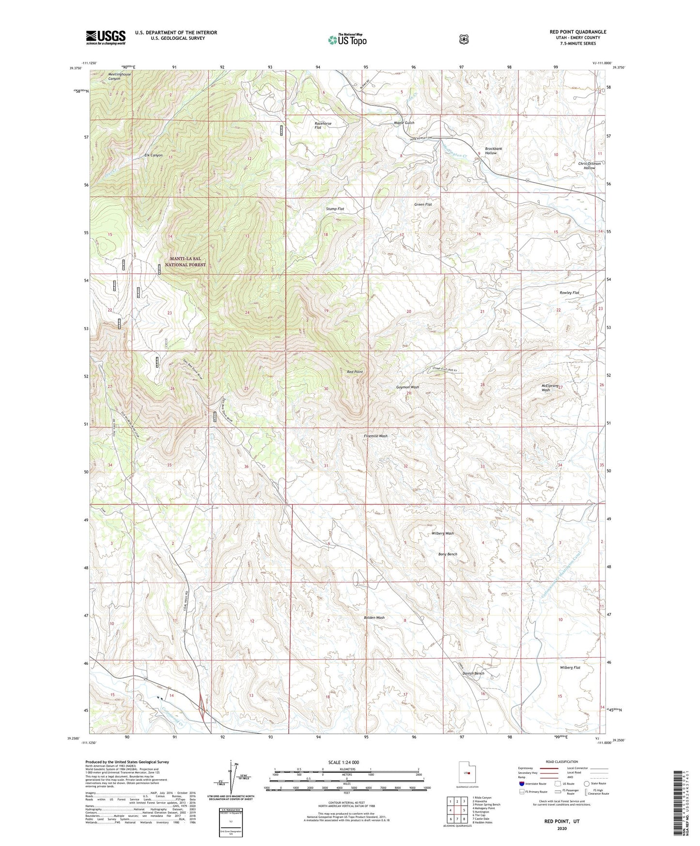
2020 topographic map quadrangle Red Point in the state of Utah. Scale: 1:24000. Based on the newly updated USGS 7.5' US Topo map series, this map is in the following counties: Emery. The map contains contour data, water features, and other items you are used to seeing on USGS maps, but also has updated roads and other features. This is the next generation of topographic maps. Printed on high-quality waterproof paper with UV fade-resistant inks.
Quads adjacent to this one:
West: Mahogany Point
Northwest: Rilda Canyon
North: Hiawatha
Northeast: Poison Spring Bench
East: Huntington
Southeast: Hadden Holes
South: Castle Dale
Southwest: The Cap
Contains the following named places: Anderson Mine, Bony Bench, Brockbank Hollow, Chris Otteson Hollow, Clipper Western Canal, Danish Bench, Deer Creek Mine, Des-Bee-Drive Mine, Elk Canyon, Fish Creek, Green Flat, Maple Gulch, Racehorse Flat, Red Point, Rowley Flat, Stump Flat, Wilberg Flat, Wilberg Mine, Wilberg Mine Memorial