MyTopo
The Cap Utah US Topo Map
Couldn't load pickup availability
Also explore the The Cap Forest Service Topo of this same quad for updated USFS data
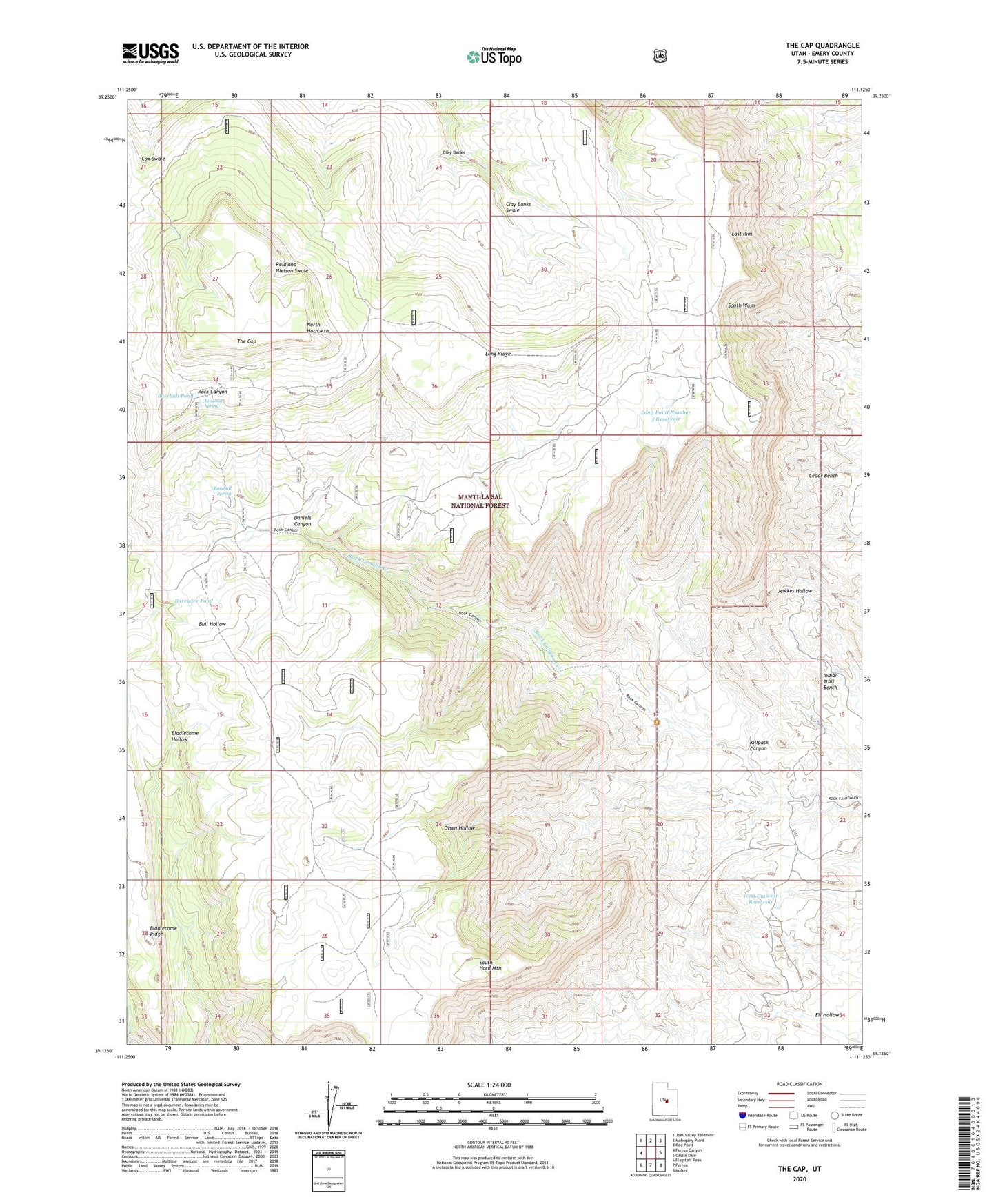
2023 topographic map quadrangle The Cap in the state of Utah. Scale: 1:24000. Based on the newly updated USGS 7.5' US Topo map series, this map is in the following counties: Emery. The map contains contour data, water features, and other items you are used to seeing on USGS maps, but also has updated roads and other features. This is the next generation of topographic maps. Printed on high-quality waterproof paper with UV fade-resistant inks.
Quads adjacent to this one:
West: Ferron Canyon
Northwest: Joes Valley Reservoir
North: Mahogany Point
Northeast: Red Point
East: Castle Dale
Southeast: Molen
South: Ferron
Southwest: Flagstaff Peak
This map covers the same area as the classic USGS quad with code o39111b2.
Contains the following named places: Anderson Mine, Barewire Pond, Baseball Pond, Baseball Spring, Clay Banks, Daniels Canyon, East Rim, Eil Hollow, Killpack Canyon, Killpack Mine, Long Point Number 3 Reservoir, Long Ridge, North Horn Mountain, Olsen Hollow, South Horn Mountain, The Cap, West Clawson Reservoir