MyTopo
Hiawatha Utah US Topo Map
Couldn't load pickup availability
Also explore the Hiawatha Forest Service Topo of this same quad for updated USFS data
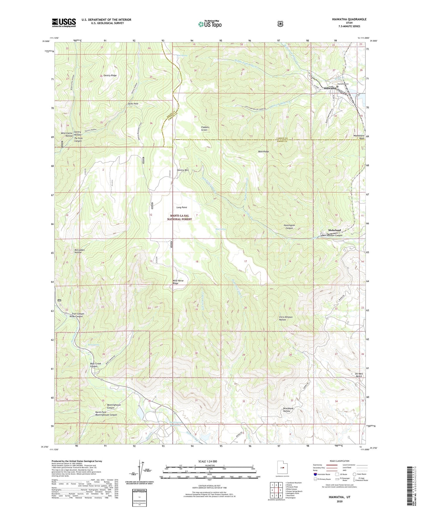
2023 topographic map quadrangle Hiawatha in the state of Utah. Scale: 1:24000. Based on the newly updated USGS 7.5' US Topo map series, this map is in the following counties: Emery, Carbon. The map contains contour data, water features, and other items you are used to seeing on USGS maps, but also has updated roads and other features. This is the next generation of topographic maps. Printed on high-quality waterproof paper with UV fade-resistant inks.
Quads adjacent to this one:
West: Rilda Canyon
Northwest: Candland Mountain
North: Wattis
Northeast: Pinnacle Peak
East: Poison Spring Bench
Southeast: Huntington
South: Red Point
Southwest: Mahogany Point
This map covers the same area as the classic USGS quad with code o39111d1.
Contains the following named places: Bald Ridge, Bear Creek Campground, Bear Creek Canyon, Ben Johnson Canyon, Birch Spring, Blackhawk Mine, Chris Otteson Trail, Co-op Mine, Deer Creek, Fiddlers Green, Gentry Hollow, Hiawatha, Hiawatha Cemetery, Hiawatha Mine, Huntington Canyon, Huntington Dam, Huntington Reservoir, Jacks Hole, King Mine, King Number Four and Number Five Mine, King Number Two Mine, Left Fork Cedar Creek, Left Fork Fish Creek, Left Fork Miller Creek, Long Point, McCadden Hollow, Meetinghouse Canyon, Middle Fork Miller Creek, Mohrland, Mohrland Mine, Mud Spring, North Fork Meetinghouse Canyon, Oil Well Bench, Pine Spring, Right Fork Cedar Creek, Right Fork Fish Creek, Right Fork Miller Creek, Rilda Canyon, Trail Canyon, Wild Cattle Hollow, Wild Horse Ridge, ZIP Code: 84528