
MyTopo
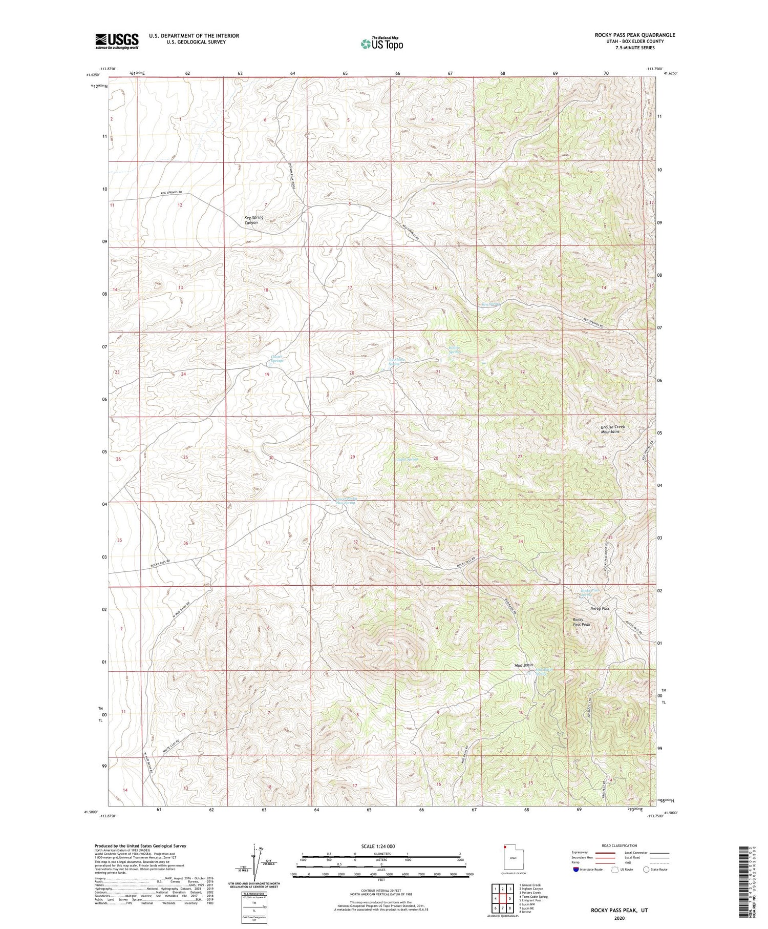
Rocky Pass Peak Utah US Topo Map
Couldn't load pickup availability
2020 topographic map quadrangle Rocky Pass Peak in the state of Utah. Scale: 1:24000. Based on the newly updated USGS 7.5' US Topo map series, this map is in the following counties: Box Elder. The map contains contour data, water features, and other items you are used to seeing on USGS maps, but also has updated roads and other features. This is the next generation of topographic maps. Printed on high-quality waterproof paper with UV fade-resistant inks.
Quads adjacent to this one:
West: Toms Cabin Spring
Northwest: Grouse Creek
North: Ingham Canyon
Northeast: Potters Creek
East: Emigrant Pass
Southeast: Bovine
South: Lucin NE
Southwest: Lucin NW
Contains the following named places: Cedar Spring, Cluster Springs, Coal Mine Spring, Government Well, Keg Spring, Keg Spring Canyon, Lower Rocky Pass Spring, Mud Basin, Mud Basin Spring, Rocky Pass, Rocky Pass Peak, Rocky Pass Spring, Willow Springs


