MyTopo
Grouse Creek Utah US Topo Map
Couldn't load pickup availability
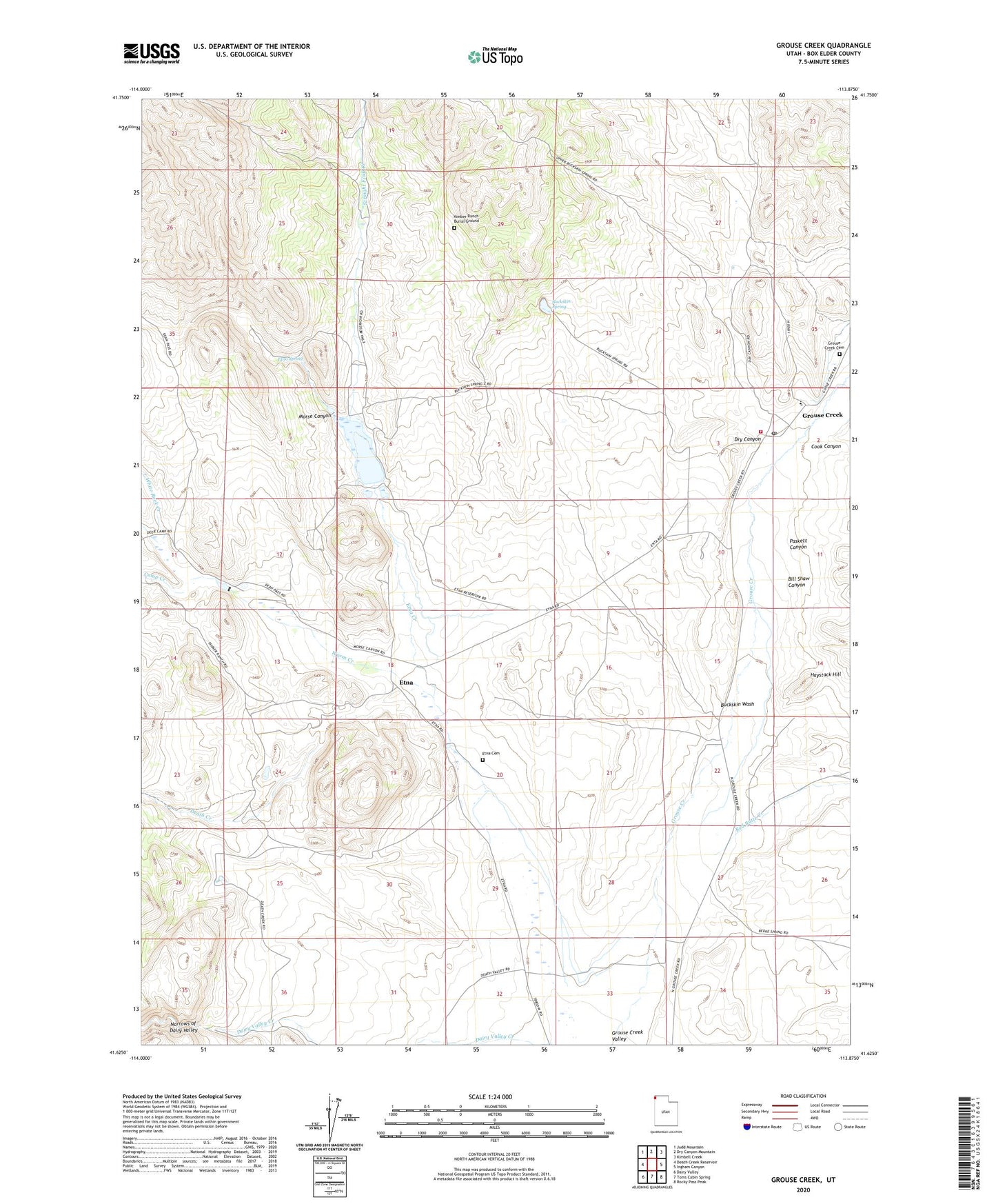
2023 topographic map quadrangle Grouse Creek in the state of Utah. Scale: 1:24000. Based on the newly updated USGS 7.5' US Topo map series, this map is in the following counties: Box Elder. The map contains contour data, water features, and other items you are used to seeing on USGS maps, but also has updated roads and other features. This is the next generation of topographic maps. Printed on high-quality waterproof paper with UV fade-resistant inks.
Quads adjacent to this one:
West: Death Creek Reservoir
Northwest: Judd Mountain
North: Dry Canyon Mountain
Northeast: Kimbell Creek
East: Ingham Canyon
Southeast: Rocky Pass Peak
South: Toms Cabin Spring
Southwest: Dairy Valley
This map covers the same area as the classic USGS quad with code o41113f8.
Contains the following named places: Bill Shaw Canyon, Buckskin Spring, Buckskin Wash, Camp Creek, Cook Canyon, Death Creek, Dry Canyon, Etna, Etna Cemetery, Etna Reservoir, Etna Spring, Grouse Creek, Grouse Creek Ambulance, Grouse Creek Cemetery, Grouse Creek Fire Department, Grouse Creek Post Office, Grouse Creek Secondary School, Haystack Hill, Kimber Ranch, Kimber Ranch Burial Ground, Morse Canyon, Paskett Canyon, Red Butte Creek, Straight Fork Creek, The Church of Jesus Christ of Latter Day Saints, Warm Creek, ZIP Code: 84313