MyTopo
Rozel Point Utah US Topo Map
Couldn't load pickup availability
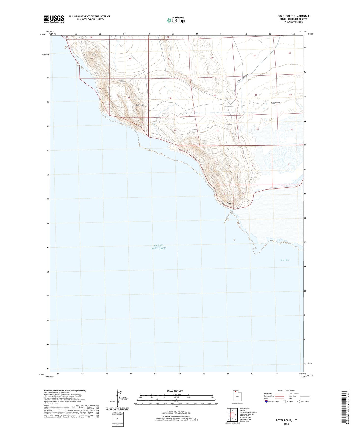
2023 topographic map quadrangle Rozel Point in the state of Utah. Scale: 1:24000. Based on the newly updated USGS 7.5' US Topo map series, this map is in the following counties: Box Elder. The map contains contour data, water features, and other items you are used to seeing on USGS maps, but also has updated roads and other features. This is the next generation of topographic maps. Printed on high-quality waterproof paper with UV fade-resistant inks.
Quads adjacent to this one:
West: Gunnison Island NE
Northwest: Coyote Point
North: Rozel
Northeast: Golden Spike Monument
East: Messix Peak
Southeast: Indian Cove
South: Rozel Point SW
Southwest: Gunnison Island
This map covers the same area as the classic USGS quad with code o41112d6.
Contains the following named places: Rozel Flat, Rozel Hills, Rozel Point, Rozel Point Oil Field