MyTopo
Saddle Mountain Utah US Topo Map
Couldn't load pickup availability
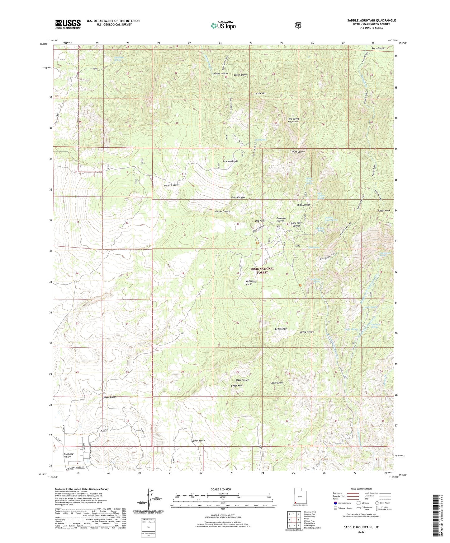
2020 topographic map quadrangle Saddle Mountain in the state of Utah. Scale: 1:24000. Based on the newly updated USGS 7.5' US Topo map series, this map is in the following counties: Washington. The map contains contour data, water features, and other items you are used to seeing on USGS maps, but also has updated roads and other features. This is the next generation of topographic maps. Printed on high-quality waterproof paper with UV fade-resistant inks.
Quads adjacent to this one:
West: Veyo
Northwest: Central West
North: Central East
Northeast: Grass Valley
East: Signal Peak
Southeast: Harrisburg Junction
South: Washington
Southwest: Santa Clara
Contains the following named places: Alger Gulch, Big Pine Spring, Burger Peak, Carter Canyon, Carter Canyon Spring, Cedar Knoll, Cottonwood Spring, Cougar Spring, Diamond Valley, Diamond Valley Ranch, East Fork Cottonwood Creek, East Fork Spring, Goat Canyon, Goat Spring, Goat Spring Trail, Grass Knoll, Indian Hollow Spring Trail, Lone Pine Canyon, Lower Spring, Mahogany Knoll, Maudsley Spring, Middle Fork Cottonwood Creek, Mud Spring, Quaking Aspen Spring, Red Knoll, Reservoir Canyon, Rock Canyon, Rock Hollow Wash, Saddle Mountain, Slide Canyon, Slide Canyon Spring, Summit Trail, Truman Bench, Washington County, West Fork Cottonwood Creek, West Fork Spring