MyTopo
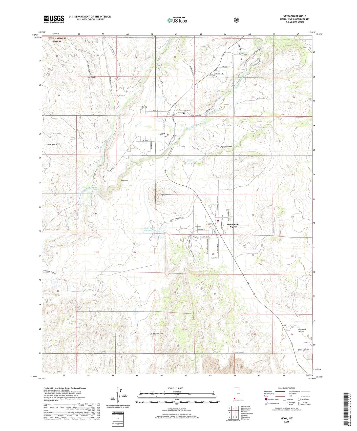
Veyo Utah US Topo Map
Couldn't load pickup availability
Also explore the Veyo Forest Service Topo of this same quad for updated USFS data
2023 topographic map quadrangle Veyo in the state of Utah. Scale: 1:24000. Based on the newly updated USGS 7.5' US Topo map series, this map is in the following counties: Washington. The map contains contour data, water features, and other items you are used to seeing on USGS maps, but also has updated roads and other features. This is the next generation of topographic maps. Printed on high-quality waterproof paper with UV fade-resistant inks.
Quads adjacent to this one:
West: Gunlock
Northwest: Maple Ridge
North: Central West
Northeast: Central East
East: Saddle Mountain
Southeast: Washington
South: Santa Clara
Southwest: Shivwits
This map covers the same area as the classic USGS quad with code o37113c6.
Contains the following named places: Cedar Spring Wash, Cottonwood Wash, Cove Wash, Dammeron Valley, Dammeron Valley Census Designated Place, Dammeron Valley Volunteer Fire Department, Granite Wash, Lower Sand Cove Dam, Lower Sand Cove Reservoir, Magotsu Creek, Manera Wash, Moody Wash, Northwestern Special Service Fire District Brookside Station, Snow Canyon State Park, The Church of Jesus Christ of Latter Day Saints, The Gulch, Tobin Wash, Upper Sand Cove Dam, Upper Sand Cove Reservoir, Veyo, Veyo Cemetery, Veyo Census Designated Place, Veyo Fire Station - Northwestern Special Service Fire District, Veyo Post Office, Veyo Volcano, Wide Canyon, ZIP Code: 84782