MyTopo
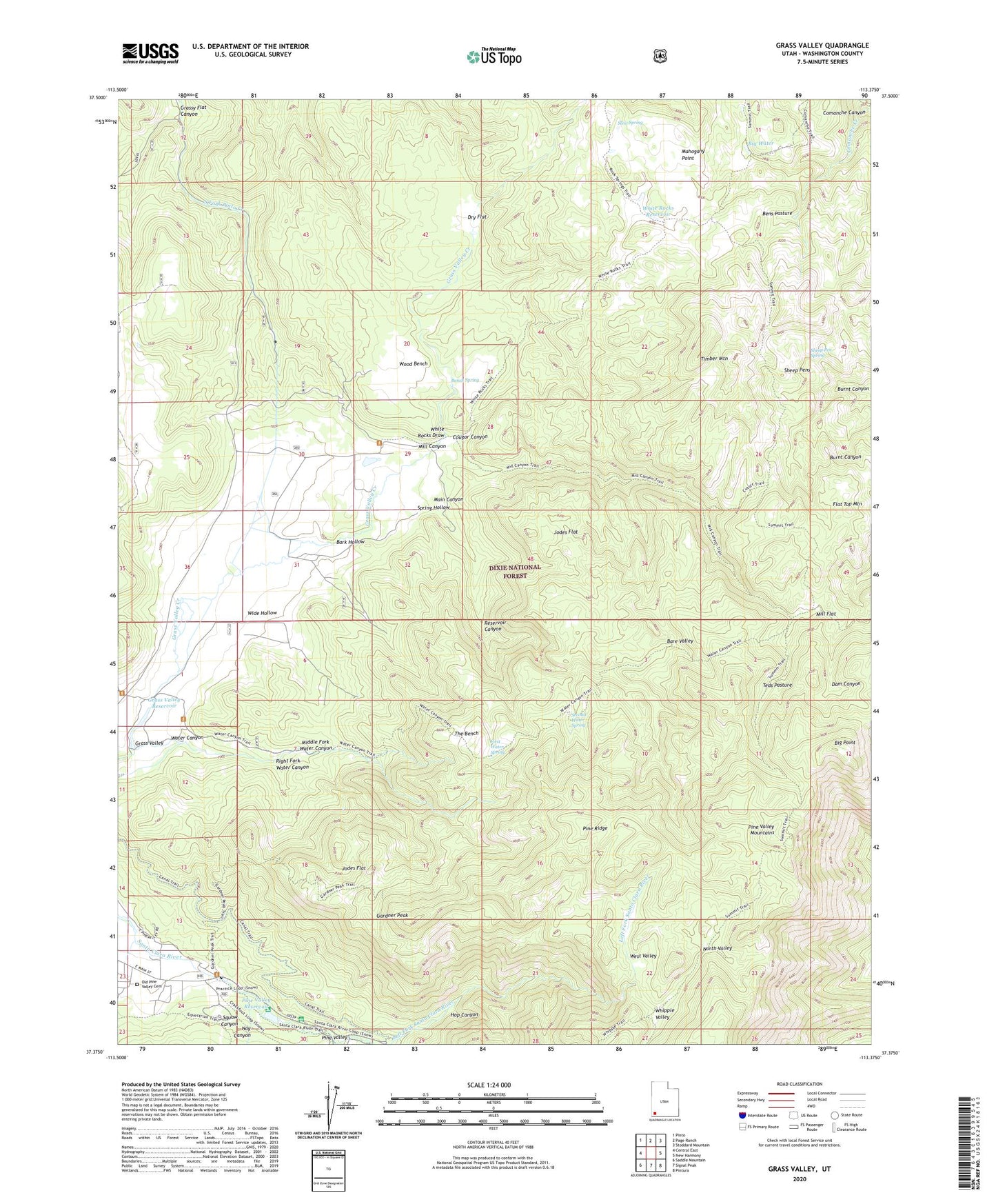
Grass Valley Utah US Topo Map
Couldn't load pickup availability
Also explore the Grass Valley Forest Service Topo of this same quad for updated USFS data
2023 topographic map quadrangle Grass Valley in the state of Utah. Scale: 1:24000. Based on the newly updated USGS 7.5' US Topo map series, this map is in the following counties: Washington. The map contains contour data, water features, and other items you are used to seeing on USGS maps, but also has updated roads and other features. This is the next generation of topographic maps. Printed on high-quality waterproof paper with UV fade-resistant inks.
Quads adjacent to this one:
West: Central East
Northwest: Pinto
North: Page Ranch
Northeast: Stoddard Mountain
East: New Harmony
Southeast: Pintura
South: Signal Peak
Southwest: Saddle Mountain
This map covers the same area as the classic USGS quad with code o37113d4.
Contains the following named places: Bare Valley, Bark Hollow, Bench Spring, Bens Pasture, Big Point, Big Water, Comanche Canyon, Cougar Canyon, Dry Flat, First Water, First Water Spring, Flat Top Mountain, Gardner Peak, Gardner Peak Trail, Gardner Ranch, Grass Valley, Grass Valley Dam, Grass Valley Reservoir, Grass Valley Trail, Grassy Flat Canyon, Hop Canyon, Jodes Flat, Juniper Park Campground, Left Fork Santa Clara River, Lower Pines Campground, Mahogany Point, Main Canyon, Middle Fork Santa Clara River, Middle Fork Water Canyon, Mill Canyon, Mill Canyon Trailhead, Mill Flat, Nay Canyon, North Valley, Old Pine Valley Cemetery, Pine Ridge, Pine Valley Forest Service Facility, Pine Valley Mountain Wilderness, Pine Valley Mountains, Pine Valley Recreation Area, Pine Valley Reservoir, Pine Valley Reservoir Dam, Pines Campground, Ponderosa Campground, Rencher Ranch, Reservoir Canyon, Reservoir Canyon Trail, Right Fork Water Canyon, Second Water, Second Water Spring, Sheep Pen Spring, Sheep Pens, Slew Spring, Spring Hollow, Squaw Canyon, Teds Pasture, The Bench, Timber Mountain, Upper Pines Campground, Water Canyon, Water Canyon Trail, West Valley, Whipple Valley, White Rocks Draw, White Rocks Reservoir, White Rocks Trail, Wide Hollow, Wood Bench, ZIP Code: 84781