MyTopo
Sigurd Utah US Topo Map
Couldn't load pickup availability
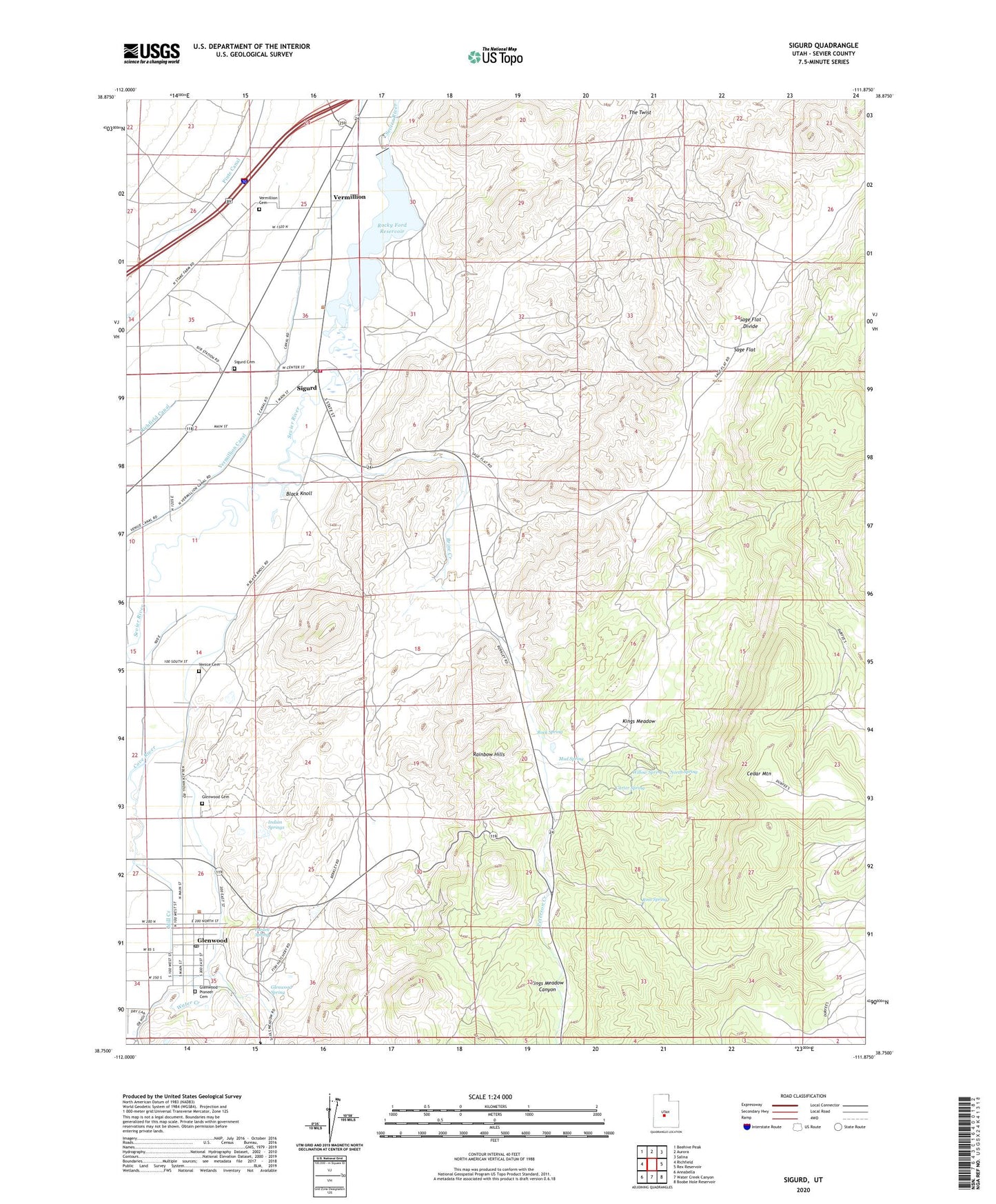
2020 topographic map quadrangle Sigurd in the state of Utah. Scale: 1:24000. Based on the newly updated USGS 7.5' US Topo map series, this map is in the following counties: Sevier. The map contains contour data, water features, and other items you are used to seeing on USGS maps, but also has updated roads and other features. This is the next generation of topographic maps. Printed on high-quality waterproof paper with UV fade-resistant inks.
Quads adjacent to this one:
West: Richfield
Northwest: Beehive Peak
North: Aurora
Northeast: Salina
East: Rex Reservoir
Southeast: Boobe Hole Reservoir
South: Water Creek Canyon
Southwest: Annabella
Contains the following named places: Black Knoll, Brine Creek, Carter Spring, Cedar Mountain, Cove River, Glenwood, Glenwood Cemetery, Glenwood Fish Hatchery, Glenwood Pioneer Cemetery, Glenwood Post Office, Glenwood Spring, Indian Springs, Kings Meadow, Kings Meadow Canyon, Mill Creek, Mud Spring, North Spring, Parcell Spring, Peterson Creek, Rainbow Hills, Rock Spring, Rocky Ford Dam, Rocky Ford Reservoir, Ross Spring, Sage Flat, Sage Flat Divide, Sigurd, Sigurd Cemetery, Sigurd Fire Department, Sigurd Post Office, Sigurd Substation, The Church of Jesus Christ of Latter Day Saints, Town of Glenwood, Town of Sigurd, Venice Canal, Venice Cemetery, Vermillion, Vermillion Canal, Vermillion Cemetery, Willow Spring, ZIP Code: 84657