MyTopo
Water Creek Canyon Utah US Topo Map
Couldn't load pickup availability
Also explore the Water Creek Canyon Forest Service Topo of this same quad for updated USFS data
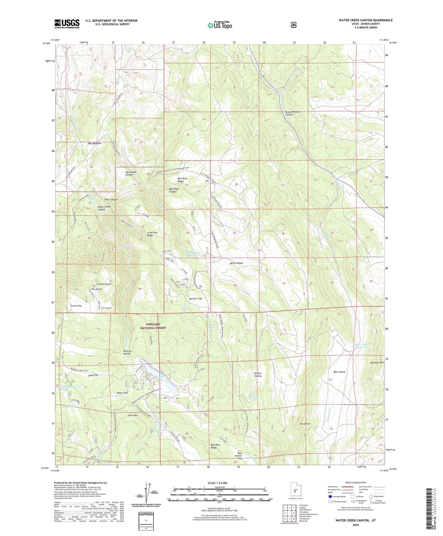
2023 topographic map quadrangle Water Creek Canyon in the state of Utah. Scale: 1:24000. Based on the newly updated USGS 7.5' US Topo map series, this map is in the following counties: Sevier. The map contains contour data, water features, and other items you are used to seeing on USGS maps, but also has updated roads and other features. This is the next generation of topographic maps. Printed on high-quality waterproof paper with UV fade-resistant inks.
Quads adjacent to this one:
West: Annabella
Northwest: Richfield
North: Sigurd
Northeast: Rex Reservoir
East: Boobe Hole Reservoir
Southeast: Burrville
South: Koosharem
Southwest: Monroe Peak
This map covers the same area as the classic USGS quad with code o38111f8.
Contains the following named places: Bear Valley, Bear Valley Reservoir, Bell Rock Canyon, Bell Rock Ridge, Big Lake, Big Lake Reservoir Dam, Brimhall Springs, Chicken Gulch, Christensen Spring, Circle Flat, Davis Hollow, Davis Hollow Reservoir, Deep Lake, Deep Lake Dam, East Hunter Flat, Henries Hollow, Hunters Flat, Hunters Spring, Killian Hollow, Killian Spring, Lone Pine Ridge, Long Flat, Red Pine Ridge, Rock Canyon, Sand Ledges Recreation Area, Saul Meadow, Squeedunk Canyon, The Brink, The Circle, Water Creek, Water Creek Canyon, Water Flat, White Pine Creek