MyTopo
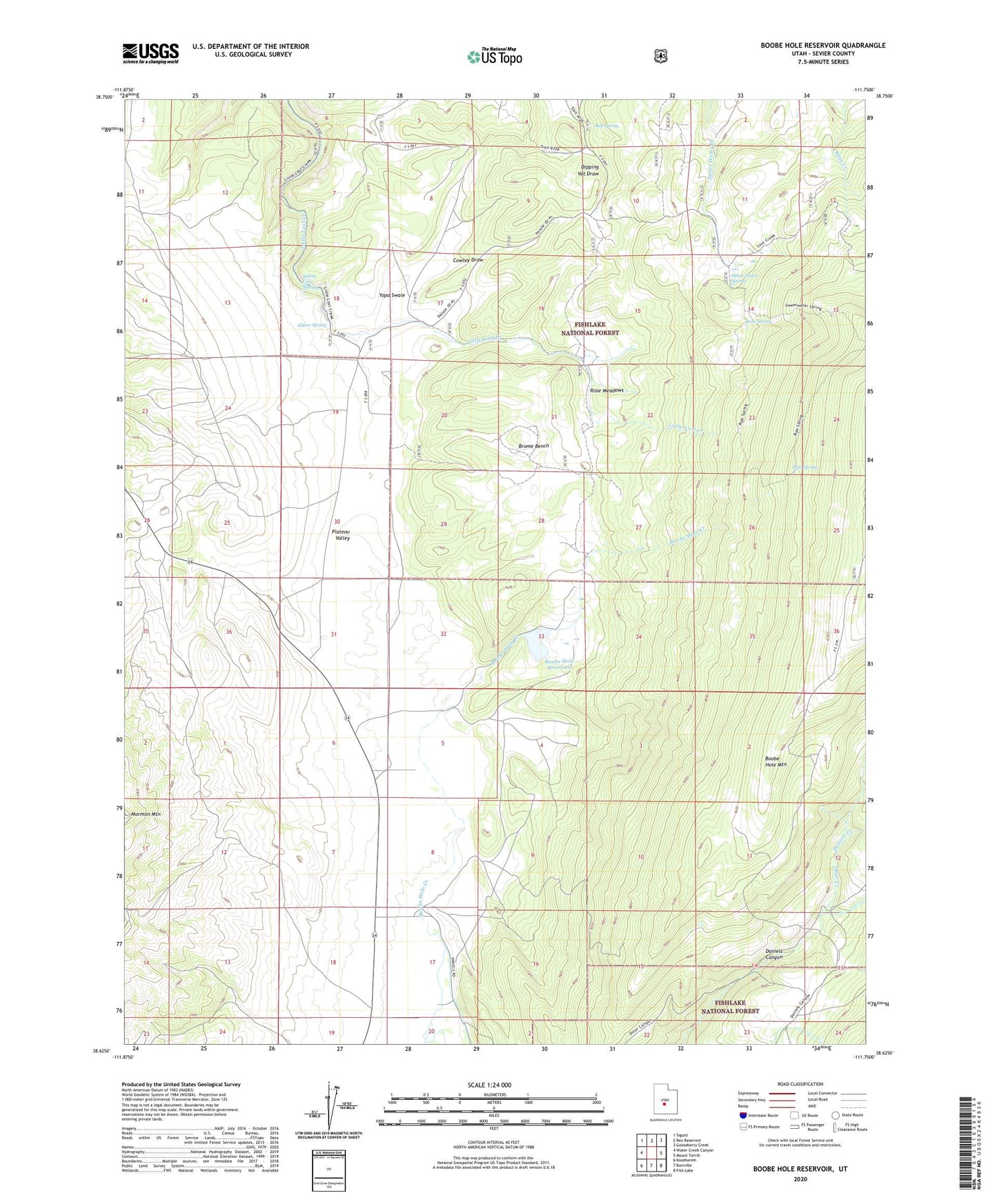
Boobe Hole Reservoir Utah US Topo Map
Couldn't load pickup availability
Also explore the Boobe Hole Reservoir Forest Service Topo of this same quad for updated USFS data
2023 topographic map quadrangle Boobe Hole Reservoir in the state of Utah. Scale: 1:24000. Based on the newly updated USGS 7.5' US Topo map series, this map is in the following counties: Sevier. The map contains contour data, water features, and other items you are used to seeing on USGS maps, but also has updated roads and other features. This is the next generation of topographic maps. Printed on high-quality waterproof paper with UV fade-resistant inks.
Quads adjacent to this one:
West: Water Creek Canyon
Northwest: Sigurd
North: Rex Reservoir
Northeast: Gooseberry Creek
East: Mount Terrill
Southeast: Fish Lake
South: Burrville
Southwest: Koosharem
This map covers the same area as the classic USGS quad with code o38111f7.
Contains the following named places: Boobe Hole Dam, Boobe Hole Reservoir, Brome Bench, Bull Spring, Cowley Draw, Daniels Creek, Elbow Spring, Mormon Mountain, Pipe Spring, Rose Meadows, Rose Spring, Salina City Spring, Sevier County, Sweet Water Spring, Yopa Swale