MyTopo
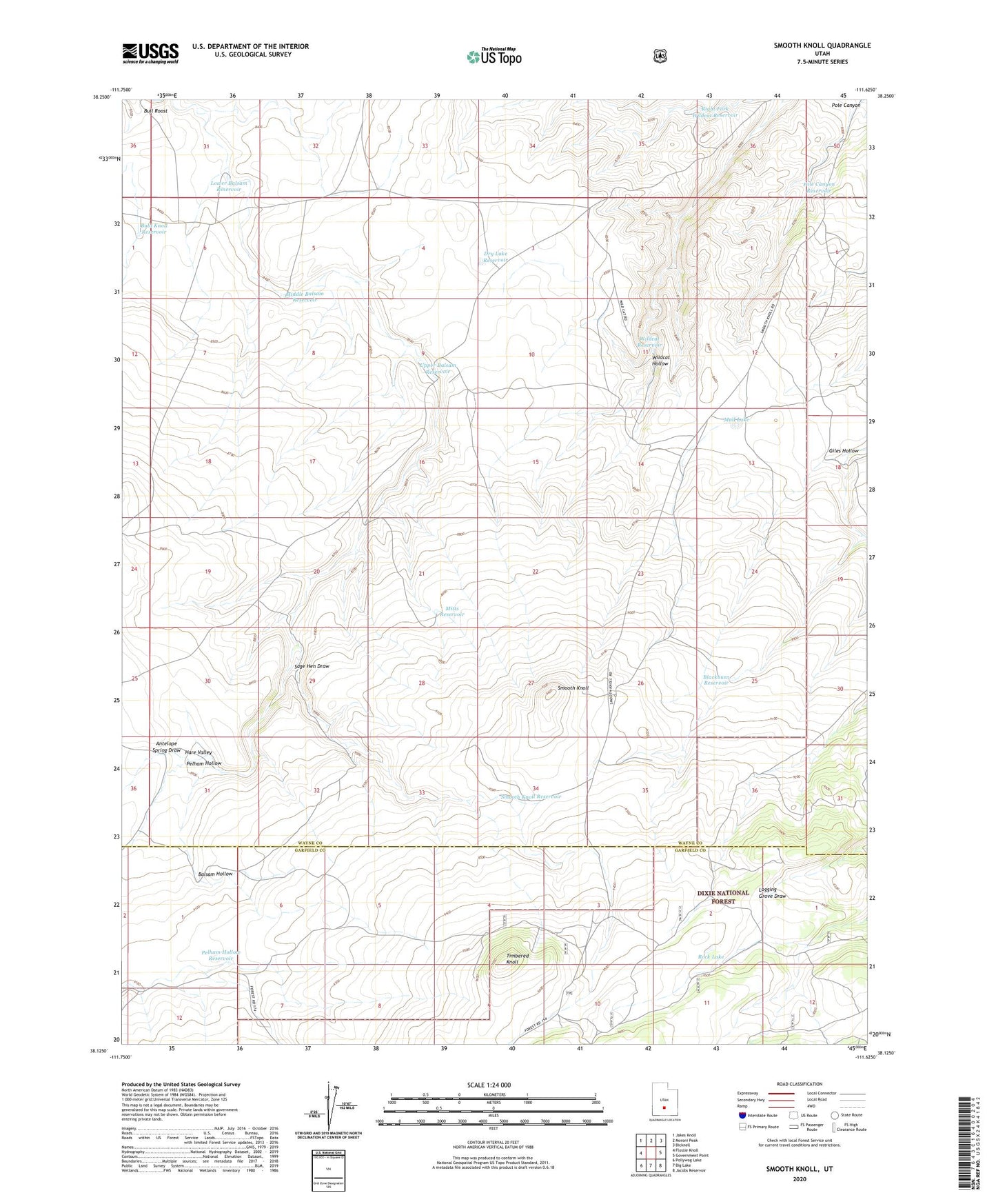
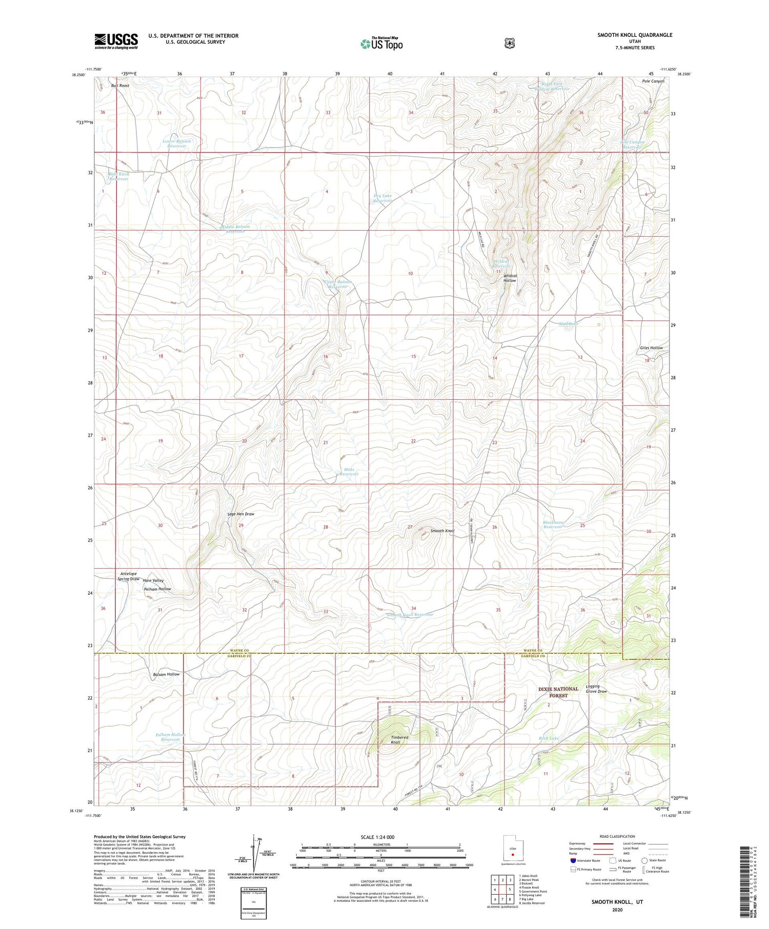
Smooth Knoll Utah US Topo Map
Couldn't load pickup availability
2020 topographic map quadrangle Smooth Knoll in the state of Utah. Scale: 1:24000. Based on the newly updated USGS 7.5' US Topo map series, this map is in the following counties: Wayne, Garfield. The map contains contour data, water features, and other items you are used to seeing on USGS maps, but also has updated roads and other features. This is the next generation of topographic maps. Printed on high-quality waterproof paper with UV fade-resistant inks.
Quads adjacent to this one:
West: Flossie Knoll
Northwest: Jakes Knoll
North: Moroni Peak
Northeast: Bicknell
East: Government Point
Southeast: Jacobs Reservoir
South: Big Lake
Southwest: Pollywog Lake
Contains the following named places: Antelope Spring Draw, Bald Knoll Reservoir, Blackburn Reservoir, Dry Lake Reservoir, Hare Valley, Lower Balsam Reservoir, Middle Balsam Reservoir, Mitts Reservoir, Mud Lake, Pelham Hollow, Pelham Hollow Reservoir, Pole Canyon, Pole Canyon Reservoir, Right Fork Wildcat Reservoir, Rock Lake, Sage Hen Draw, Smooth Knoll, Smooth Knoll Reservoir, Timbered Knoll, Upper Balsam Reservoir, Wildcat Reservoir