MyTopo
Jacobs Reservoir Utah US Topo Map
Couldn't load pickup availability
Also explore the Jacobs Reservoir Forest Service Topo of this same quad for updated USFS data
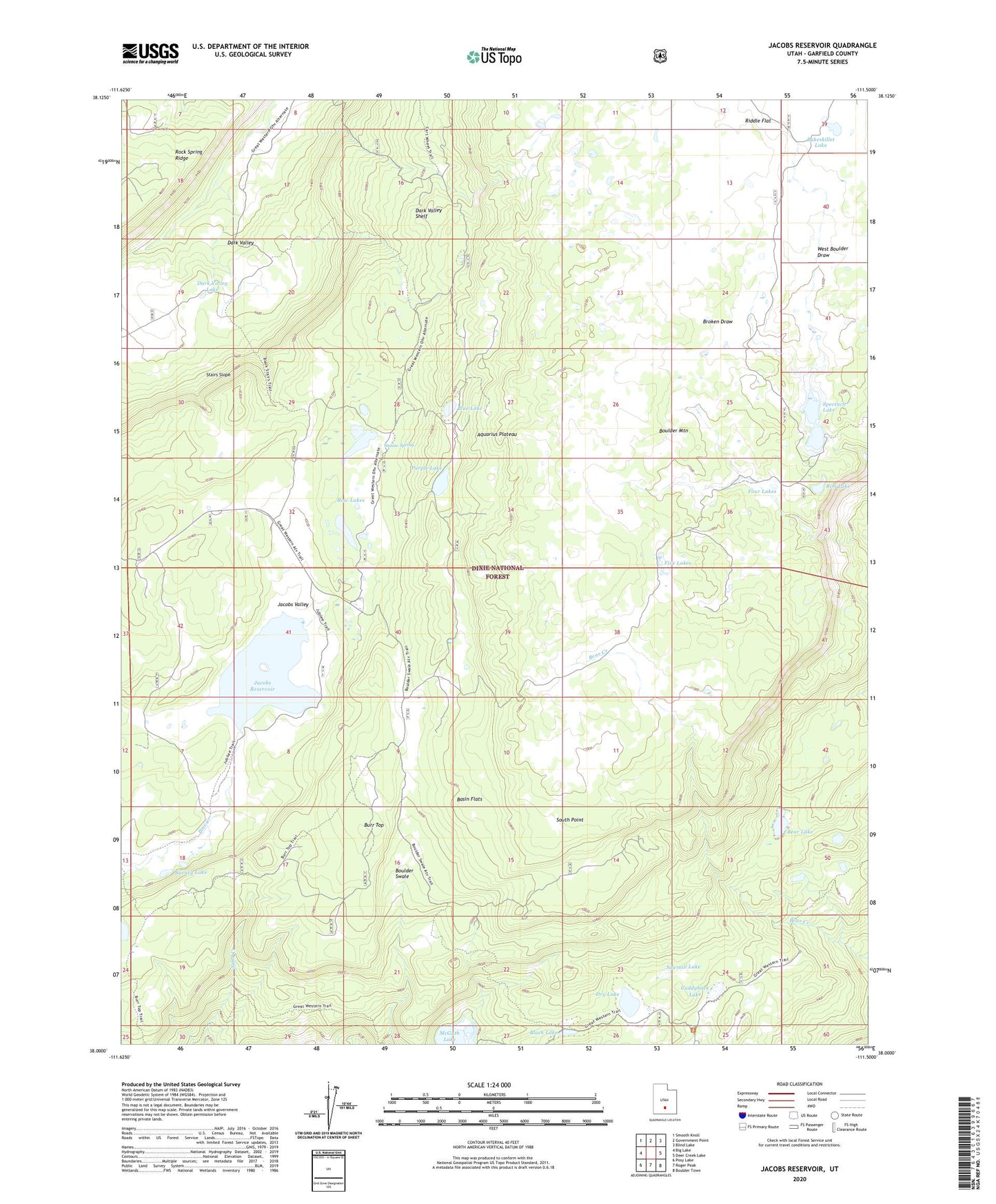
2023 topographic map quadrangle Jacobs Reservoir in the state of Utah. Scale: 1:24000. Based on the newly updated USGS 7.5' US Topo map series, this map is in the following counties: Garfield. The map contains contour data, water features, and other items you are used to seeing on USGS maps, but also has updated roads and other features. This is the next generation of topographic maps. Printed on high-quality waterproof paper with UV fade-resistant inks.
Quads adjacent to this one:
West: Big Lake
Northwest: Smooth Knoll
North: Government Point
Northeast: Blind Lake
East: Deer Creek Lake
Southeast: Boulder Town
South: Roger Peak
Southwest: Posy Lake
This map covers the same area as the classic USGS quad with code o38111a5.
Contains the following named places: Bakeskillet Lake, Barney Lake, Basin Flats, Bear Lake, Black Lake, Blue Lake, Boulder Swale, Broken Draw, Burr Top, Cuddyback Lake, Dark Valley Lake, Dark Valley Shelf, Dry Lake, Five Lakes, Four Lakes, Jacobs Reservoir, Jacobs Valley, Jacobs Valley Dam, McGath Lake, Purple Lake, Riddle Flat, Rim Lake, Row Lakes, Sawmill Lake, South Point, Spectacle Lake, Spectacle Lake Dam, Squaw Spring, Stairs Slope, West Boulder Draw