MyTopo
Spring City Utah US Topo Map
Couldn't load pickup availability
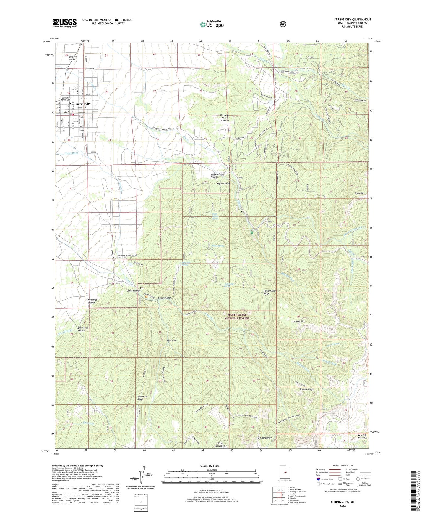
2020 topographic map quadrangle Spring City in the state of Utah. Scale: 1:24000. Based on the newly updated USGS 7.5' US Topo map series, this map is in the following counties: Sanpete. The map contains contour data, water features, and other items you are used to seeing on USGS maps, but also has updated roads and other features. This is the next generation of topographic maps. Printed on high-quality waterproof paper with UV fade-resistant inks.
Quads adjacent to this one:
West: Chester
Northwest: Moroni
North: Mount Pleasant
Northeast: Huntington Reservoir
East: South Tent Mountain
Southeast: Joes Valley Reservoir
South: Danish Knoll
Southwest: Ephraim
Contains the following named places: Acord Fork, Allred Ditch, Becks Ditch, Big Horseshoe, Bill Allred Canyon, Black Willow Canyon, Black Willow Spring, Burnout Fork, Canal Canyon, City of Spring City, Dry Lake Spring, Freeman Allred Meadow, Grizzly Gulch, Haystack Mountain, Hell Hole, Hennings Canyon, Knob Mountain, Last Chance Ditch, Little Horseshoe, Maple Canyon, Meadow Fork Oak Creek, Mill Race Ditch, North Twin Creek, Oak Ridge Spring, Point Ditch, Poulson Ridge, Powerhouse Ridge, Sawmill Fork, South Fork Oak Creek, South Twin Creek, Spring City, Spring City Elementary School, Spring City Picnic Area, Spring City Pioneer Cemetery, Spring City Police Department, Spring City Post Office, Spring City Volunteer Fire Department, Temple Fork, The Church of Jesus Christ of Latter Day Saints, Wileys Spring, ZIP Code: 84662