MyTopo
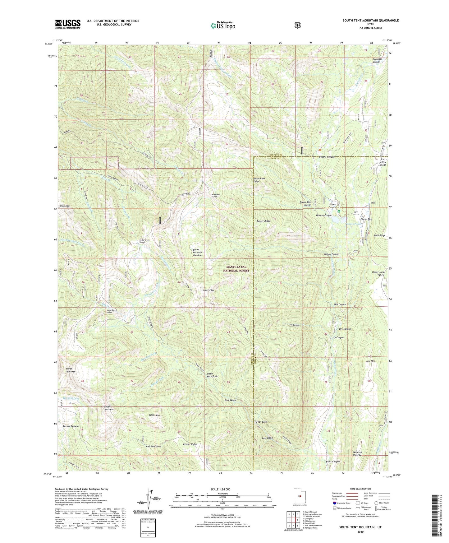
South Tent Mountain Utah US Topo Map
Couldn't load pickup availability
Also explore the South Tent Mountain Forest Service Topo of this same quad for updated USFS data
2023 topographic map quadrangle South Tent Mountain in the state of Utah. Scale: 1:24000. Based on the newly updated USGS 7.5' US Topo map series, this map is in the following counties: Sanpete, Emery. The map contains contour data, water features, and other items you are used to seeing on USGS maps, but also has updated roads and other features. This is the next generation of topographic maps. Printed on high-quality waterproof paper with UV fade-resistant inks.
Quads adjacent to this one:
West: Spring City
Northwest: Mount Pleasant
North: Huntington Reservoir
Northeast: Candland Mountain
East: Rilda Canyon
Southeast: Mahogany Point
South: Joes Valley Reservoir
Southwest: Danish Knoll
This map covers the same area as the classic USGS quad with code o39111d3.
Contains the following named places: Bacon Rind Canyon, Bacon Rind Ridge, Becks Cabin, Bennetts Canyon, Black Canyon, Booths Canyon, Brough Fork, Browns Canyon, Buck Basin, Bulger Canyon, Bulger Ridge, Cedar Creek Tunnel, Cow Fork, Dry Canyon, Elizas Fork, Fly Canyon, Hogan Basin, Little Buck Basin, Little Mountain, Lost Basin, Lowry Top, Manti National Forest, Meadow Fork, Middle Mountain, Mill Canyon, Mountain Tunnel, Mountain Tunnel Ditch, North Tent Mountain, Potters Canyon, Potters Canyon Ditch, Potters Pond Number One Dam, Potters Pond Number Two Dam, Potters Ponds, Red Pine Cove, Reeder Ridge, Scad Valley Divide, Sheep Flat, Soren Peterson Meadow, South Tent Mountain, Spring City Ditch, Spring City Tunnel