MyTopo
Moroni Utah US Topo Map
Couldn't load pickup availability
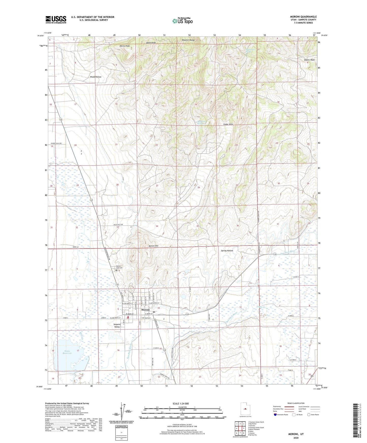
2023 topographic map quadrangle Moroni in the state of Utah. Scale: 1:24000. Based on the newly updated USGS 7.5' US Topo map series, this map is in the following counties: Sanpete. The map contains contour data, water features, and other items you are used to seeing on USGS maps, but also has updated roads and other features. This is the next generation of topographic maps. Printed on high-quality waterproof paper with UV fade-resistant inks.
Quads adjacent to this one:
West: Fountain Green South
Northwest: Fountain Green North
North: Big Hollow
Northeast: Fairview
East: Mount Pleasant
Southeast: Spring City
South: Chester
Southwest: Wales
This map covers the same area as the classic USGS quad with code o39111e5.
Contains the following named places: Apple Tree Spring, Black Knob, Cedar Creek, Christensen Spring, City of Moroni, Devils Peak, Moroni, Moroni City Cemetery, Moroni City Ditch, Moroni City Police Department, Moroni Elementary School, Moroni Hill, Moroni Post Office, Moroni Volunteer Fire Department, North Sanpete Ambulance Service Moroni, North Sanpete Middle School, Pleasant Creek, Spring Hollow, The Church of Jesus Christ of Latter Day Saints, Wales Dam, Wales Reservoir, Wood Hollow, ZIP Code: 84646