MyTopo
Stockton Utah US Topo Map
Couldn't load pickup availability
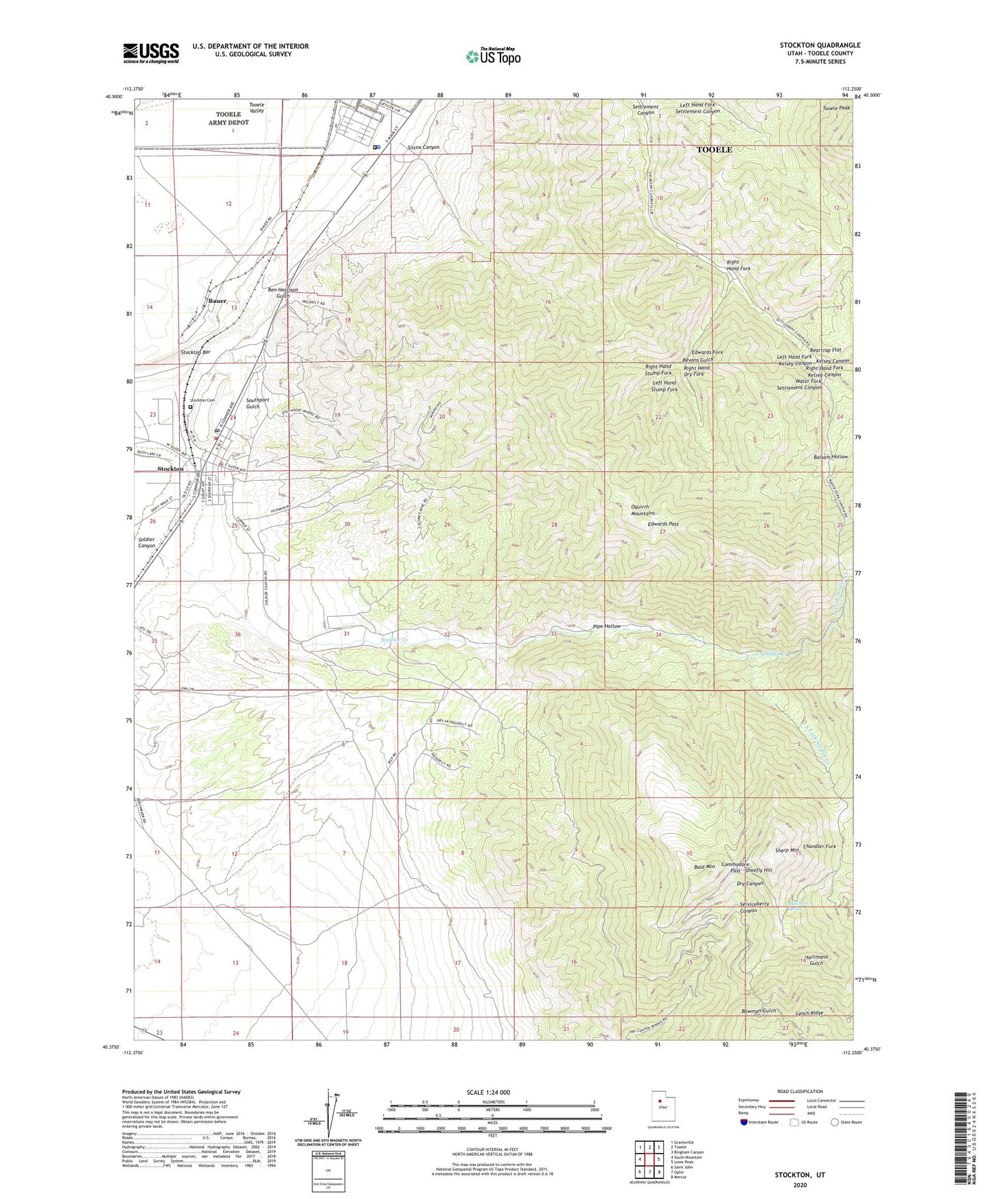
2020 topographic map quadrangle Stockton in the state of Utah. Scale: 1:24000. Based on the newly updated USGS 7.5' US Topo map series, this map is in the following counties: Tooele. The map contains contour data, water features, and other items you are used to seeing on USGS maps, but also has updated roads and other features. This is the next generation of topographic maps. Printed on high-quality waterproof paper with UV fade-resistant inks.
Quads adjacent to this one:
West: South Mountain
Northwest: Grantsville
North: Tooele
Northeast: Bingham Canyon
East: Lowe Peak
Southeast: Mercur
South: Ophir
Southwest: Saint John
Contains the following named places: Bald Mountain, Balsam Hollow, Bauer, Beartrap Flat, Ben Harrison Gulch, Ben Harrison Mine, Bevans Gulch, Buckhorn Spring, Calumet Mine, Commodore Pass, Edwards Fork, Edwards Pass, Hidden Treasure Mine, Honerine Mine, Jacob City, Kelsey Canyon, Left Hand Fork Kelsey Canyon, Left Hand Stump Fork, Legion Park Campground, Lynch Ridge, North Fork Soldier Creek, Pipe Hollow, Queen of the Hills Mine, Right Hand Dry Fork, Right Hand Fork, Right Hand Fork Kelsey Canyon, Right Hand Stump Fork, Sharp Mountain, Shoofly Hill, Silcox Canyon, South Fork Soldier Creek, Southport Gulch, Stockton, Stockton Bar, Stockton Cemetery, Stockton Police Department, Stockton Post Office, Stockton Volunteer Fire Department, Tad Park, The Church of Jesus Christ of Latter Day Saints, Tip Top Mine, Tooele County Detention Center, Tooele County Sheriff, Tooele Peak, Town of Stockton, Water Fork Settlement Canyon, ZIP Code: 84071