MyTopo
Mercur Utah US Topo Map
Couldn't load pickup availability
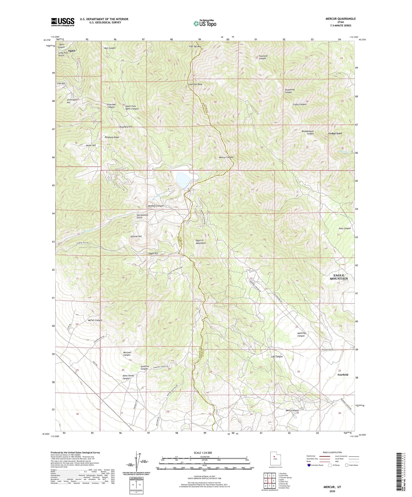
2023 topographic map quadrangle Mercur in the state of Utah. Scale: 1:24000. Based on the newly updated USGS 7.5' US Topo map series, this map is in the following counties: Utah, Tooele. The map contains contour data, water features, and other items you are used to seeing on USGS maps, but also has updated roads and other features. This is the next generation of topographic maps. Printed on high-quality waterproof paper with UV fade-resistant inks.
Quads adjacent to this one:
West: Ophir
Northwest: Stockton
North: Lowe Peak
Northeast: Tickville Spring
East: Cedar Fort
Southeast: Goshen Pass
South: Fivemile Pass
Southwest: Vernon NE
This map covers the same area as the classic USGS quad with code o40112c2.
Contains the following named places: Alma Young Canyon, Chloride Point Mine, Clay Canyon, Clay Mine, Eagle Hill, Fairfield Station, Flat Top Mountain, Geyser-Marion Mine, Golden Gate Mine, Hall Canyon, Lewiston Peak, Lion Hill, Long Trail Gulch, Manning, Manning Canyon, McFait Canyon, Meadow Canyon, Mercur, Mitchell Canyon, Ophir Census Designated Place, Pole Canyon, Porphyry Hill, Porphyry Knob, Rover Hill, Sacramento Gulch, Sacramento Mine, Silveropolis Hill, Sunrise Hill, Sunshine, Sunshine Canyon, Violet Ray Mine, Wells Canyon