MyTopo
Talmage Utah US Topo Map
Couldn't load pickup availability
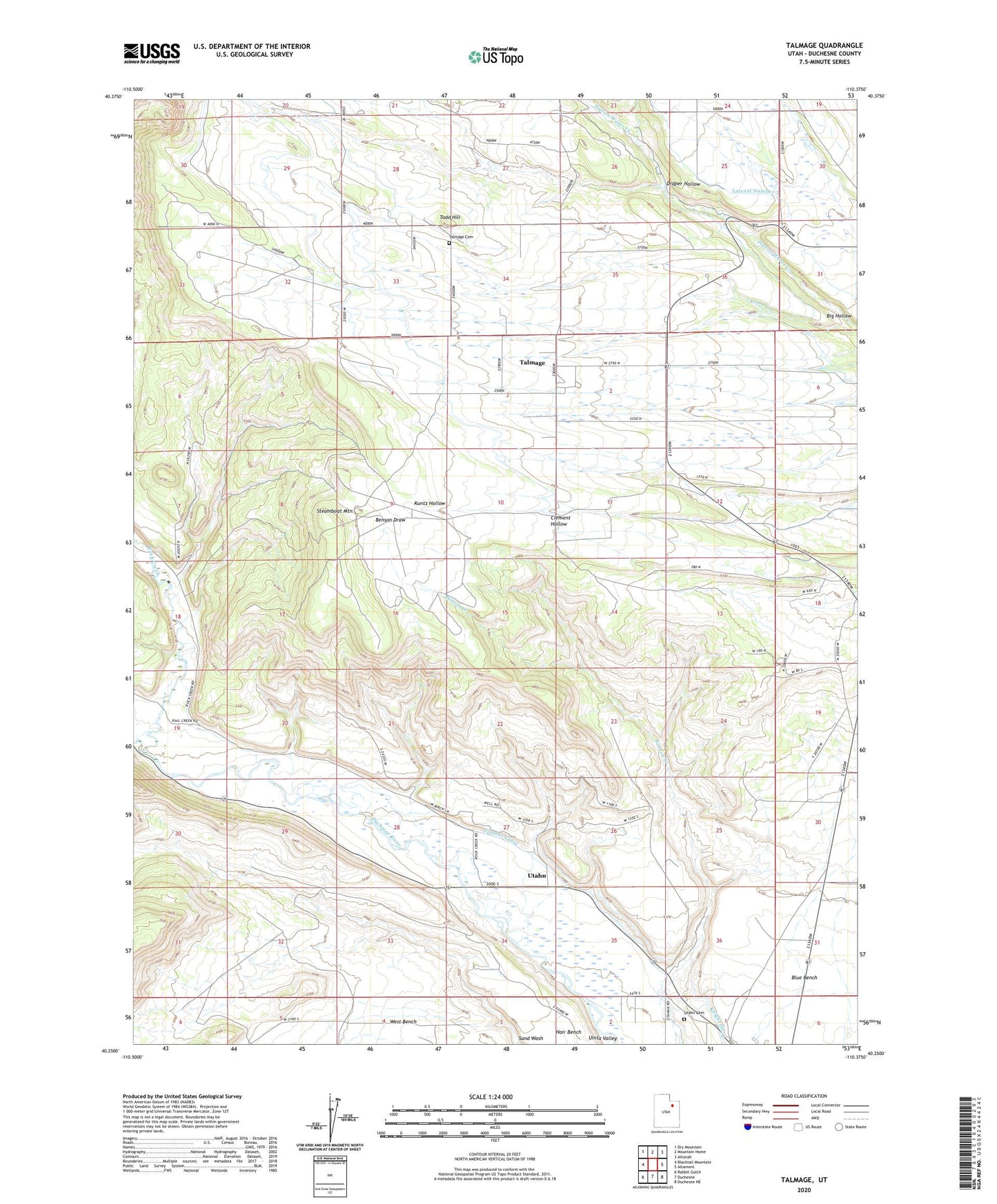
2020 topographic map quadrangle Talmage in the state of Utah. Scale: 1:24000. Based on the newly updated USGS 7.5' US Topo map series, this map is in the following counties: Duchesne. The map contains contour data, water features, and other items you are used to seeing on USGS maps, but also has updated roads and other features. This is the next generation of topographic maps. Printed on high-quality waterproof paper with UV fade-resistant inks.
Quads adjacent to this one:
West: Blacktail Mountain
Northwest: Dry Mountain
North: Mountain Home
Northeast: Altonah
East: Altamont
Southeast: Duchesne NE
South: Duchesne
Southwest: Rabbit Gulch
Contains the following named places: Draper Hollow, Duchesne County, Hair Bench, Lateral Number 3, Pioneer Canal, Rock Creek, Steamboat Mountain, Talmage, Talmage Cemetery, Todd Hill, Utahn, Utahn Cemetery, ZIP Code: 84073