MyTopo
Temple Mountain Utah US Topo Map
Couldn't load pickup availability
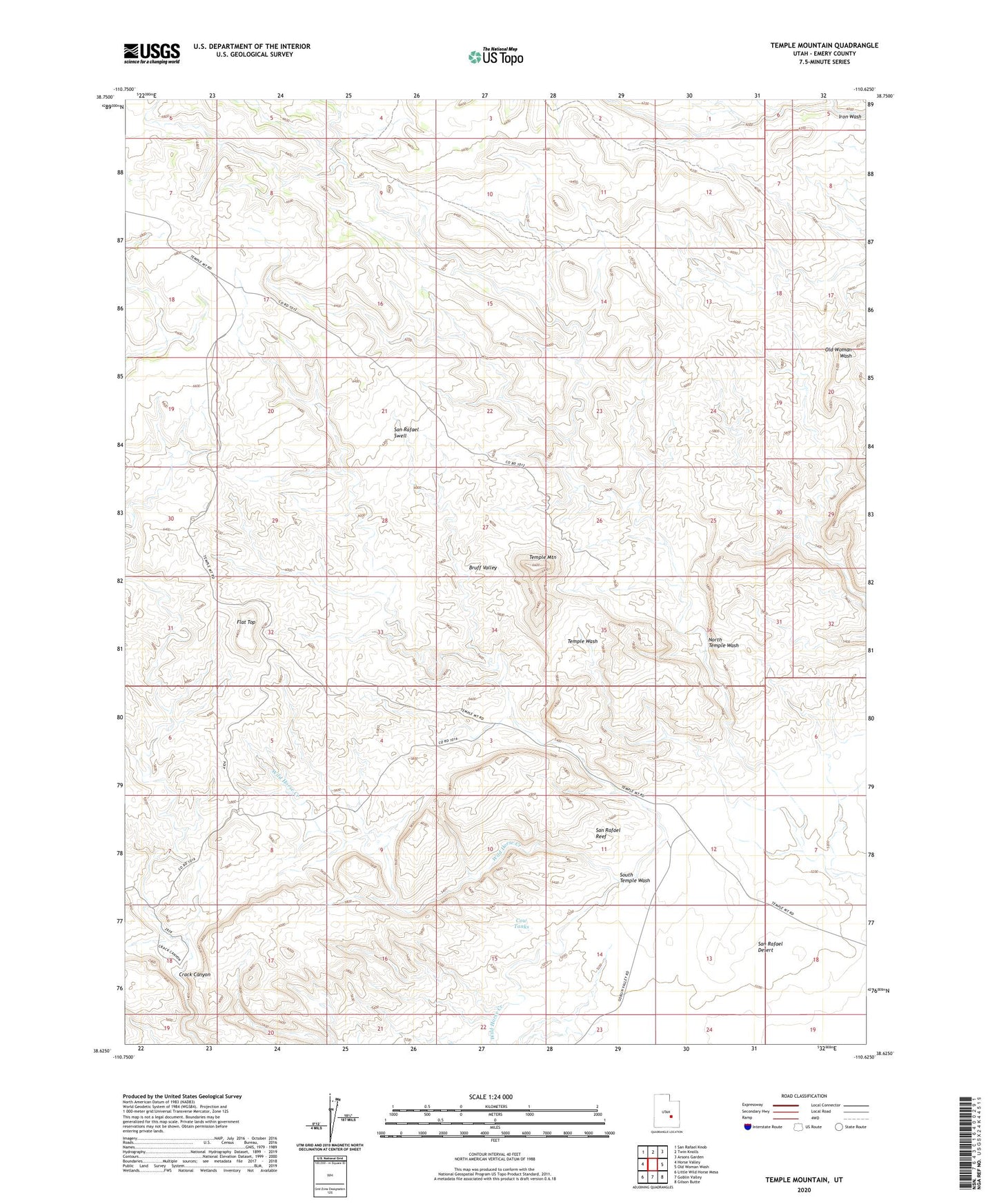
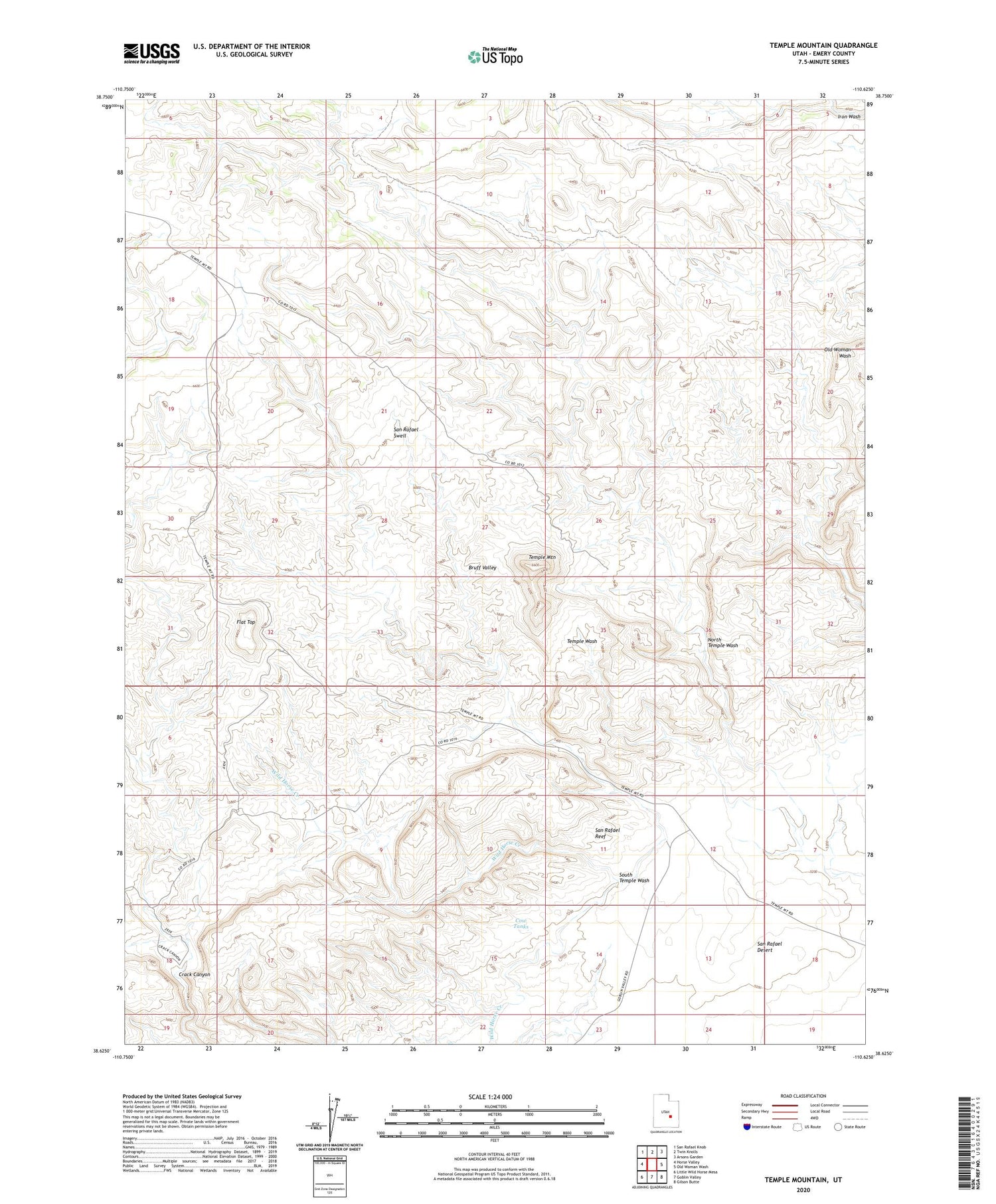
2020 topographic map quadrangle Temple Mountain in the state of Utah. Scale: 1:24000. Based on the newly updated USGS 7.5' US Topo map series, this map is in the following counties: Emery. The map contains contour data, water features, and other items you are used to seeing on USGS maps, but also has updated roads and other features. This is the next generation of topographic maps. Printed on high-quality waterproof paper with UV fade-resistant inks.
Quads adjacent to this one:
West: Horse Valley
Northwest: San Rafael Knob
North: Twin Knolls
Northeast: Arsons Garden
East: Old Woman Wash
Southeast: Gilson Butte
South: Goblin Valley
Southwest: Little Wild Horse Mesa
Contains the following named places: Bruff Valley, Cow Tanks, Flat Top, North Temple Wash, South Temple Wash, Temple Mountain