MyTopo
Twin Knolls Utah US Topo Map
Couldn't load pickup availability
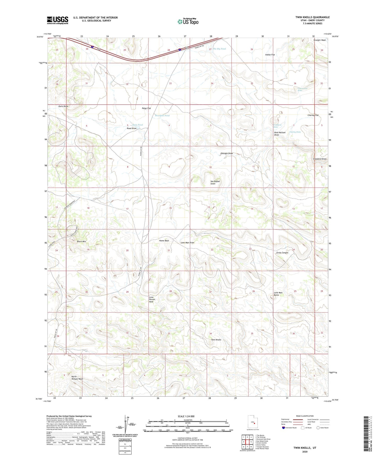
2023 topographic map quadrangle Twin Knolls in the state of Utah. Scale: 1:24000. Based on the newly updated USGS 7.5' US Topo map series, this map is in the following counties: Emery. The map contains contour data, water features, and other items you are used to seeing on USGS maps, but also has updated roads and other features. This is the next generation of topographic maps. Printed on high-quality waterproof paper with UV fade-resistant inks.
Quads adjacent to this one:
West: San Rafael Knob
Northwest: The Blocks
North: The Wickiup
Northeast: Drowned Hole Draw
East: Arsons Garden
Southeast: Old Woman Wash
South: Temple Mountain
Southwest: Horse Valley
This map covers the same area as the classic USGS quad with code o38110g6.
Contains the following named places: Block Mountain, Charley Flat, Charley Holes, Cottonwood Holes, Crawford Holes, Earls Draw, Georges Draw, Georges Draw Well, Home Base, Indian Flat, Lone Man Butte, Lone Parson Hole, Paige Flat, Reid Neilson Draw, Road Draw, San Rafael Swell, Sinbad Country, State Pond, The Big Pond, Twin Knolls, Woodpile Pond