MyTopo
Wah Wah Summit Utah US Topo Map
Couldn't load pickup availability
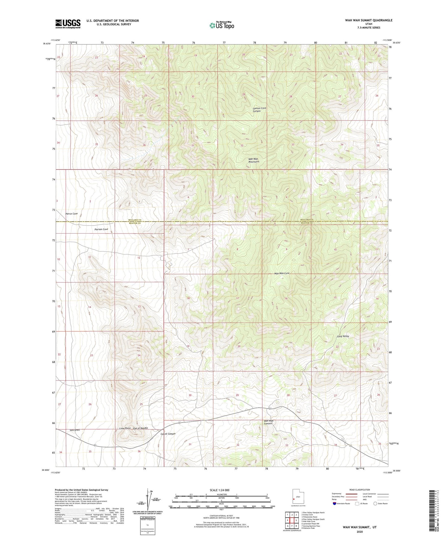
2020 topographic map quadrangle Wah Wah Summit in the state of Utah. Scale: 1:24000. Based on the newly updated USGS 7.5' US Topo map series, this map is in the following counties: Beaver, Millard. The map contains contour data, water features, and other items you are used to seeing on USGS maps, but also has updated roads and other features. This is the next generation of topographic maps. Printed on high-quality waterproof paper with UV fade-resistant inks.
Quads adjacent to this one:
West: Pine Valley Hardpan South
Northwest: Pine Valley Hardpan North
North: Grassy Cove
Northeast: Fifteenmile Point
East: Wah Wah Cove
Southeast: Wallaces Peak
South: Sewing Machine Pass
Southwest: Lamerdorf Peak NW
Contains the following named places: Corral Canyon, Eye of Needle, Lime Point, Pierce Cove, Pierson Cove, Sols Knoll, Wah Wah Summit