MyTopo
Wallsburg Ridge Utah US Topo Map
Couldn't load pickup availability
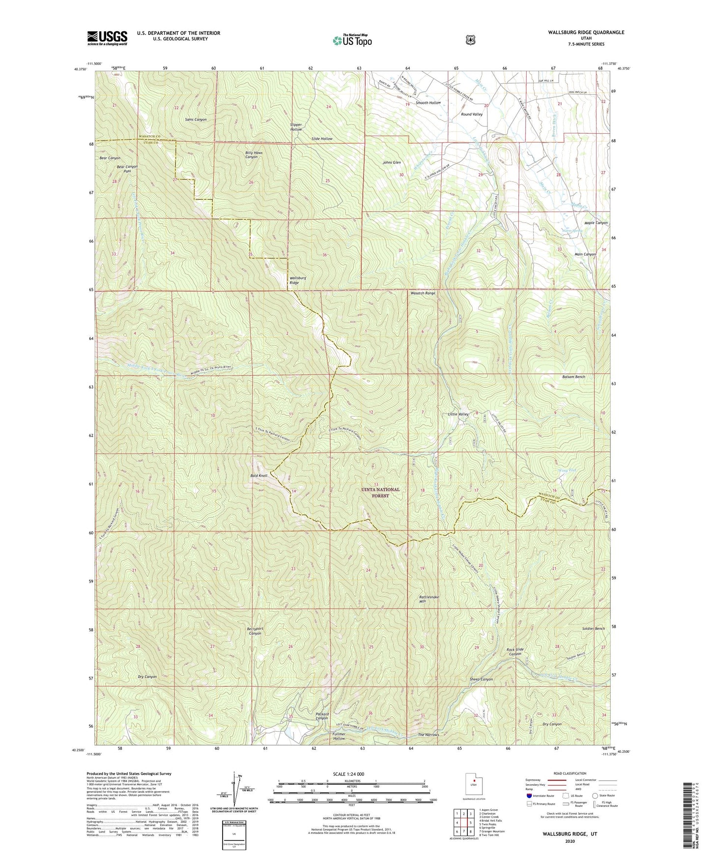
2020 topographic map quadrangle Wallsburg Ridge in the state of Utah. Scale: 1:24000. Based on the newly updated USGS 7.5' US Topo map series, this map is in the following counties: Utah, Wasatch. The map contains contour data, water features, and other items you are used to seeing on USGS maps, but also has updated roads and other features. This is the next generation of topographic maps. Printed on high-quality waterproof paper with UV fade-resistant inks.
Quads adjacent to this one:
West: Bridal Veil Falls
Northwest: Aspen Grove
North: Charleston
Northeast: Center Creek
East: Twin Peaks
Southeast: Two Tom Hill
South: Granger Mountain
Southwest: Springville
Contains the following named places: Bald Knoll, Balsam Bench, Balsam Creek, Bear Canyon Pass, Boren Ditch, Fullmer Hollow, Johns Glen, Left Fork Little Hobble Creek, Little Valley, Main Canyon, Maple Creek, Packard Canyon, Penrod Creek, Rattlesnake Mountain, Right Fork Little Hobble Creek, Rock Slide Canyon, Schoolhouse Creek, Sheep Canyon, Slide Hollow, Slipper Hollow, Smooth Hollow, Soldier Bench, The Narrows, Wallsburg Ridge, Warm Spring, Whipstock Creek, Wing Flat, ZIP Code: 84082