MyTopo
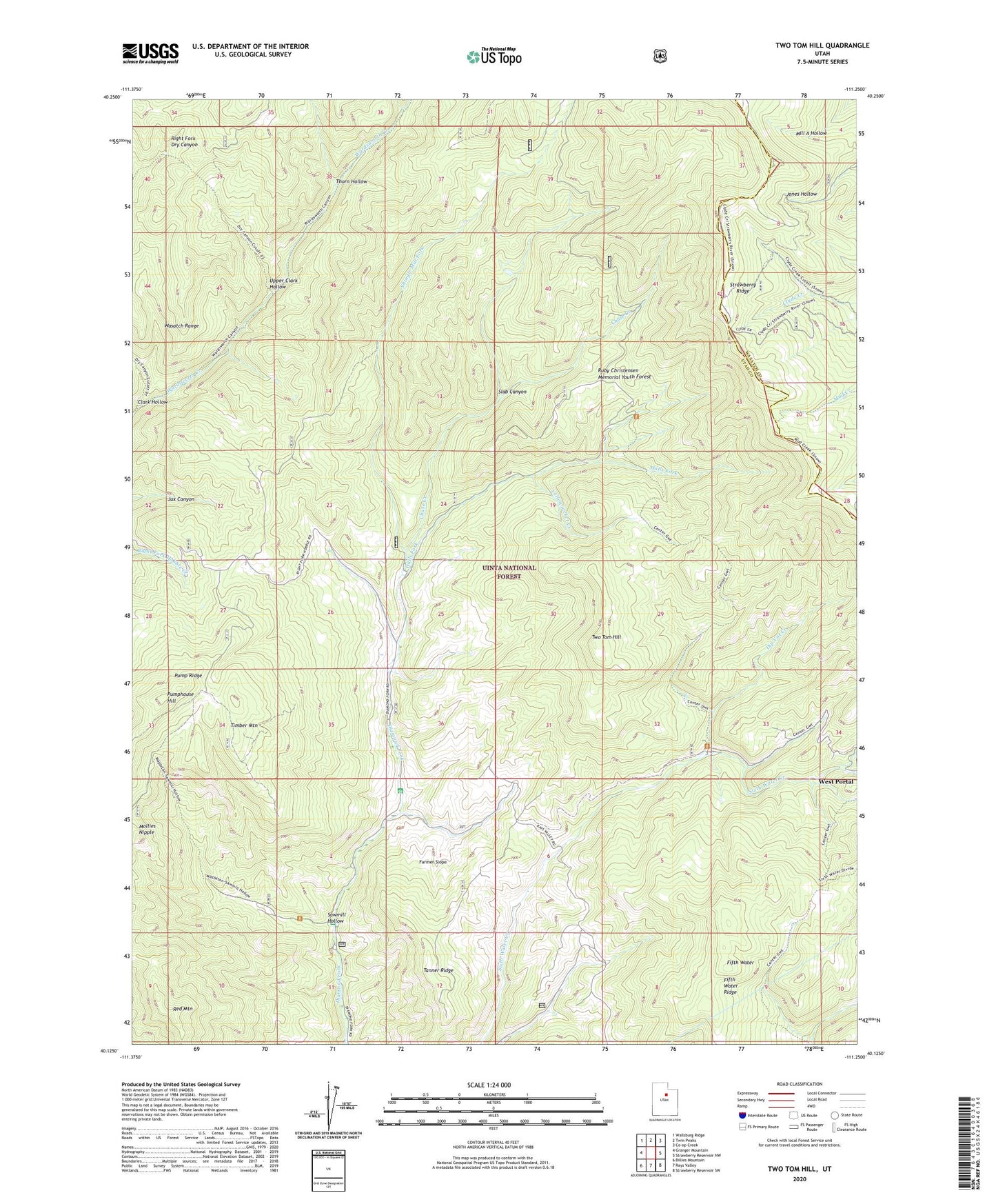
Two Tom Hill Utah US Topo Map
Couldn't load pickup availability
Also explore the Two Tom Hill Forest Service Topo of this same quad for updated USFS data
2023 topographic map quadrangle Two Tom Hill in the state of Utah. Scale: 1:24000. Based on the newly updated USGS 7.5' US Topo map series, this map is in the following counties: Utah, Wasatch. The map contains contour data, water features, and other items you are used to seeing on USGS maps, but also has updated roads and other features. This is the next generation of topographic maps. Printed on high-quality waterproof paper with UV fade-resistant inks.
Quads adjacent to this one:
West: Granger Mountain
Northwest: Wallsburg Ridge
North: Twin Peaks
Northeast: Co-op Creek
East: Strawberry Reservoir NW
Southeast: Strawberry Reservoir SW
South: Rays Valley
Southwest: Billies Mountain
This map covers the same area as the classic USGS quad with code o40111b3.
Contains the following named places: Chase Creek, Clark Hollow, Diamond Fork Guard Station, Dip Vat Creek, Farmer Slope, Fifth Water, Fifth Water Ridge, Halls Fork, Hawthorn Campground, Mineral Spring Campground, Mollies Nipple, Pump Ridge, Pumphouse Hill, Red Mountain, Ruby Christensen Memorial Youth Forest, Sawmill Hollow, Shingle Mill Fork, Slab Canyon, Springville Crossings, Tanner Ridge, Thorn Hollow, Timber Mountain, Two Tom Hill, Upper Clark Hollow, West Portal, Yellowjacket Creek