MyTopo
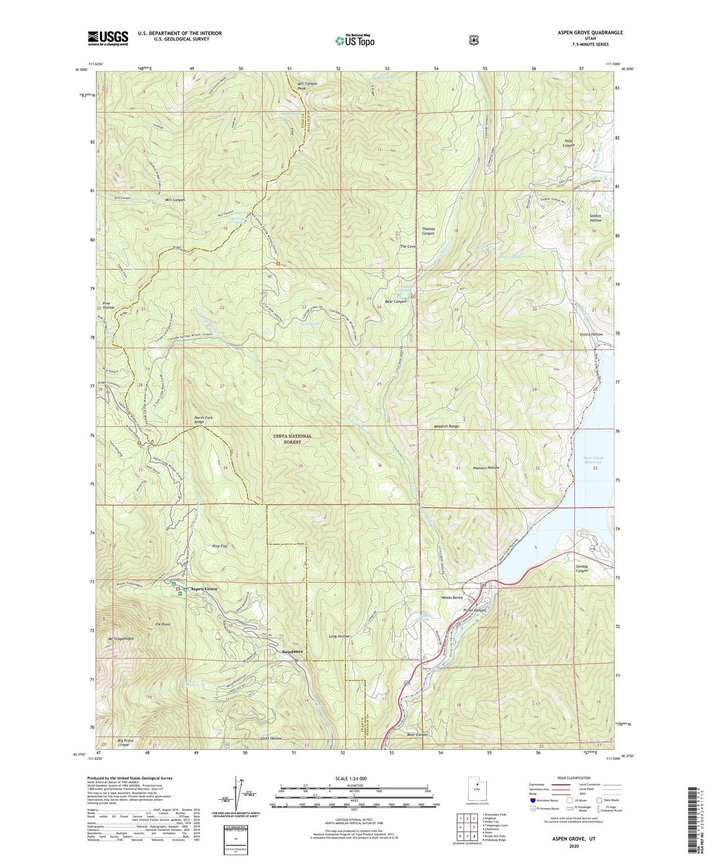
Aspen Grove Utah US Topo Map
Couldn't load pickup availability
Also explore the Aspen Grove Forest Service Topo of this same quad for updated USFS data
2023 topographic map quadrangle Aspen Grove in the state of Utah. Scale: 1:24000. Based on the newly updated USGS 7.5' US Topo map series, this map is in the following counties: Wasatch, Utah. The map contains contour data, water features, and other items you are used to seeing on USGS maps, but also has updated roads and other features. This is the next generation of topographic maps. Printed on high-quality waterproof paper with UV fade-resistant inks.
Quads adjacent to this one:
West: Timpanogos Cave
Northwest: Dromedary Peak
North: Brighton
Northeast: Heber City
East: Charleston
Southeast: Wallsburg Ridge
South: Bridal Veil Falls
Southwest: Orem
This map covers the same area as the classic USGS quad with code o40111d5.
Contains the following named places: Alpine Summer School, Aspen Grove, Bear Canyon, Big Tree Campground, Cascade Springs, Decker Creek, Decker Spring, Deer Creek Dam, Deer Creek State Park, Dry Lake, Elk Point, Forest Camp, Girls M I A Camp, Heber City West Division, Hoovers Hollow, Lame Horse Campground, Long Hollow, Mill Canyon Peak, Mill Canyon Spring, Mount Timpanogos Campground, Mount Timpanogos Trail, Mud Spring, North Fork Fire Department, North Fork Ridge, Pine Flat, Pole Canyon, Provo Deer Creek, Red Pine Creek, Riverbend Trailer Park, Rock Spring, Scotts Hollow, Soldier Hollow, South Fork Deer Creek, Stewarts Cascades, Sulphur Spring, Summit Campground, Sundance, Sundance Census Designated Place, Sundance Ski Area, Sunday Canyon, The Cove, Theater in the Pines, Thomas Canyon, Tooth Spring, Wasatch Mountain State Park, Weeks Bench