
MyTopo
White Mesa Village Utah US Topo Map
Couldn't load pickup availability
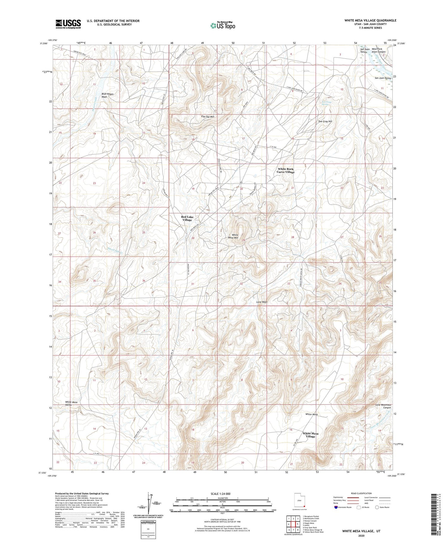
2020 topographic map quadrangle White Mesa Village in the state of Utah. Scale: 1:24000. Based on the newly updated USGS 7.5' US Topo map series, this map is in the following counties: San Juan. The map contains contour data, water features, and other items you are used to seeing on USGS maps, but also has updated roads and other features. This is the next generation of topographic maps. Printed on high-quality waterproof paper with UV fade-resistant inks.
Quads adjacent to this one:
West: Hogan Mesa
Northwest: Recapture Pocket
North: Montezuma Creek
Northeast: Navajo Canyon
East: Aneth
Southeast: Yellow Rock Point West
South: White Mesa Village SE
Southwest: Gray Spot Rock
Contains the following named places: Aztec Camp, Blue Hogan Wash, Casa del Eco Mesa-White Mesa Division, Continental Camp, Flat Top Mountain, Lone Wash, Red Lake Village, Sahgzie Creek, Tow Gray Hill, Tow Gray Spring, West Fork Allen Canyon, White Mesa, White Mesa Mountain, White Mesa Valley, White Mesa Village, White Rock Curve Village


