
MyTopo
Wickiup Canyon Utah US Topo Map
Couldn't load pickup availability
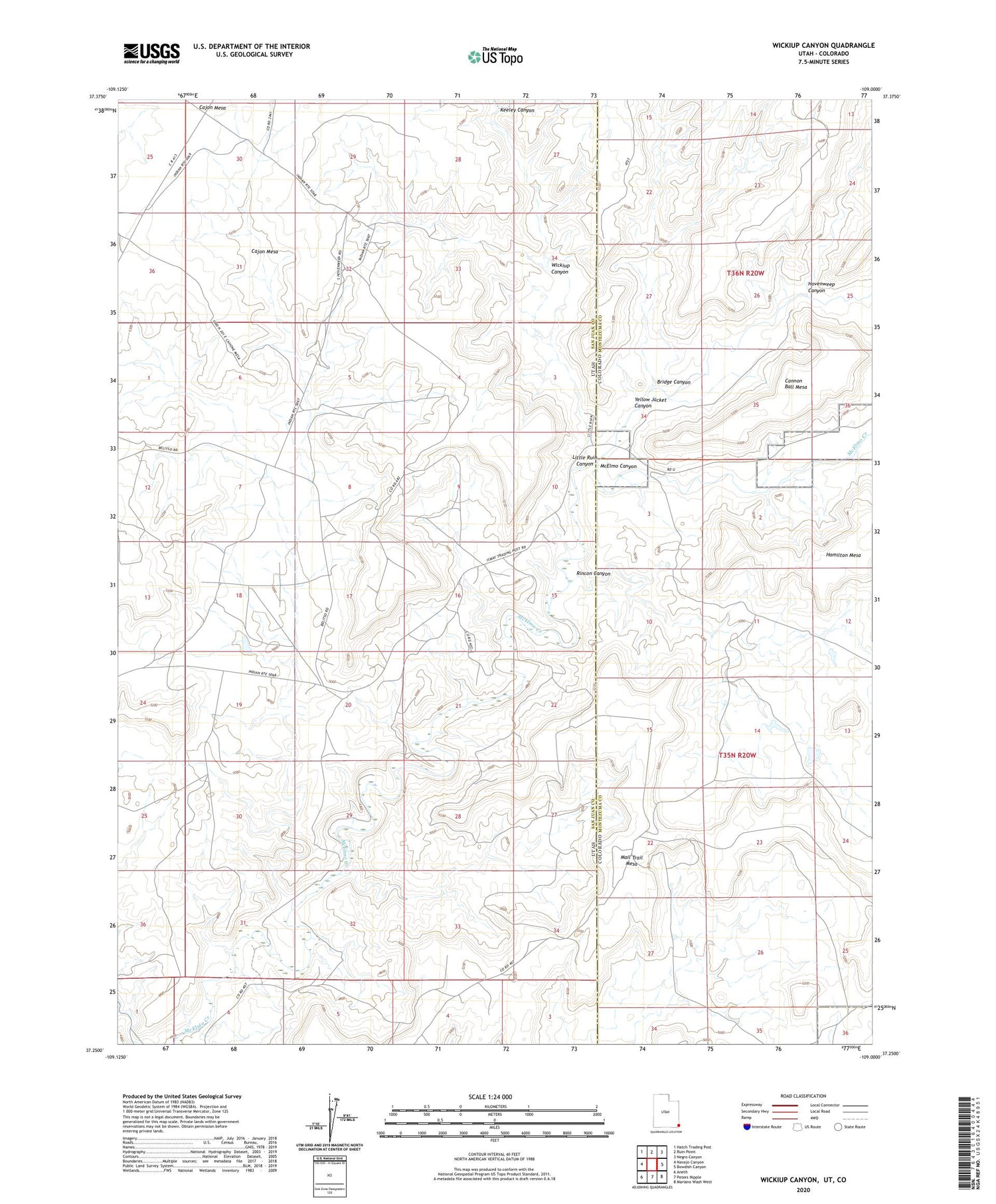
2020 topographic map quadrangle Wickiup Canyon in the states of Utah, Colorado. Scale: 1:24000. Based on the newly updated USGS 7.5' US Topo map series, this map is in the following counties: San Juan, Montezuma. The map contains contour data, water features, and other items you are used to seeing on USGS maps, but also has updated roads and other features. This is the next generation of topographic maps. Printed on high-quality waterproof paper with UV fade-resistant inks.
Quads adjacent to this one:
West: Navajo Canyon
Northwest: Hatch Trading Post
North: Ruin Point
Northeast: Negro Canyon
East: Bowdish Canyon
Southeast: Mariano Wash West
South: Peters Nipple
Southwest: Aneth
Contains the following named places: Bridge Canyon, Cajon Mesa, Hovenweep Canyon, Ismay Oil Field, Ismay Trading Post, Keeley Canyon, Little Ruin Canyon, Mail Trail Mesa, McElmo Canyon, Rincon Canyon, Wickiup Canyon, Yellow Jacket Canyon


