MyTopo
Ruin Point Utah US Topo Map
Couldn't load pickup availability
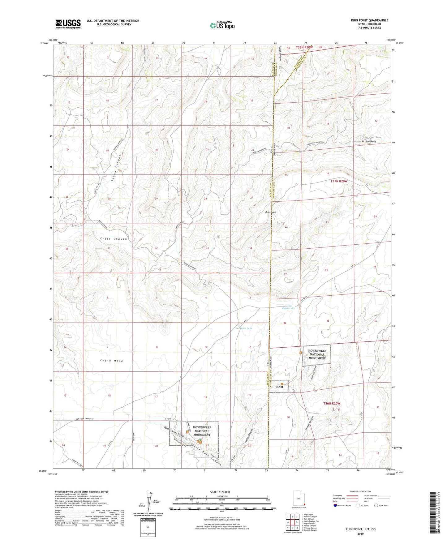
2023 topographic map quadrangle Ruin Point in the states of Utah, Colorado. Scale: 1:24000. Based on the newly updated USGS 7.5' US Topo map series, this map is in the following counties: San Juan, Montezuma, Dolores. The map contains contour data, water features, and other items you are used to seeing on USGS maps, but also has updated roads and other features. This is the next generation of topographic maps. Printed on high-quality waterproof paper with UV fade-resistant inks.
Quads adjacent to this one:
West: Hatch Trading Post
Northwest: Bug Canyon
North: Papoose Canyon
Northeast: Ruin Canyon
East: Negro Canyon
Southeast: Bowdish Canyon
South: Wickiup Canyon
Southwest: Navajo Canyon
This map covers the same area as the classic USGS quad with code o37109d1.
Contains the following named places: Cajon Lake, Eroded Bowlder House, Hackberry Canyon, Hackberry Group, Holly House, Horseshoe House, Hovenweep Castle, Hovenweep National Monument, Hovenweep Ranger Station, Little Cajon Lake, McLean Basin, Round Tower, Ruin Point, Spook Canyon, Square Tower, Square Tower Canon, Square Tower Ruins Campground, Squaw Canyon, Stronghold House, Twin Towers, Unit Type House