MyTopo
Hatch Trading Post Utah US Topo Map
Couldn't load pickup availability
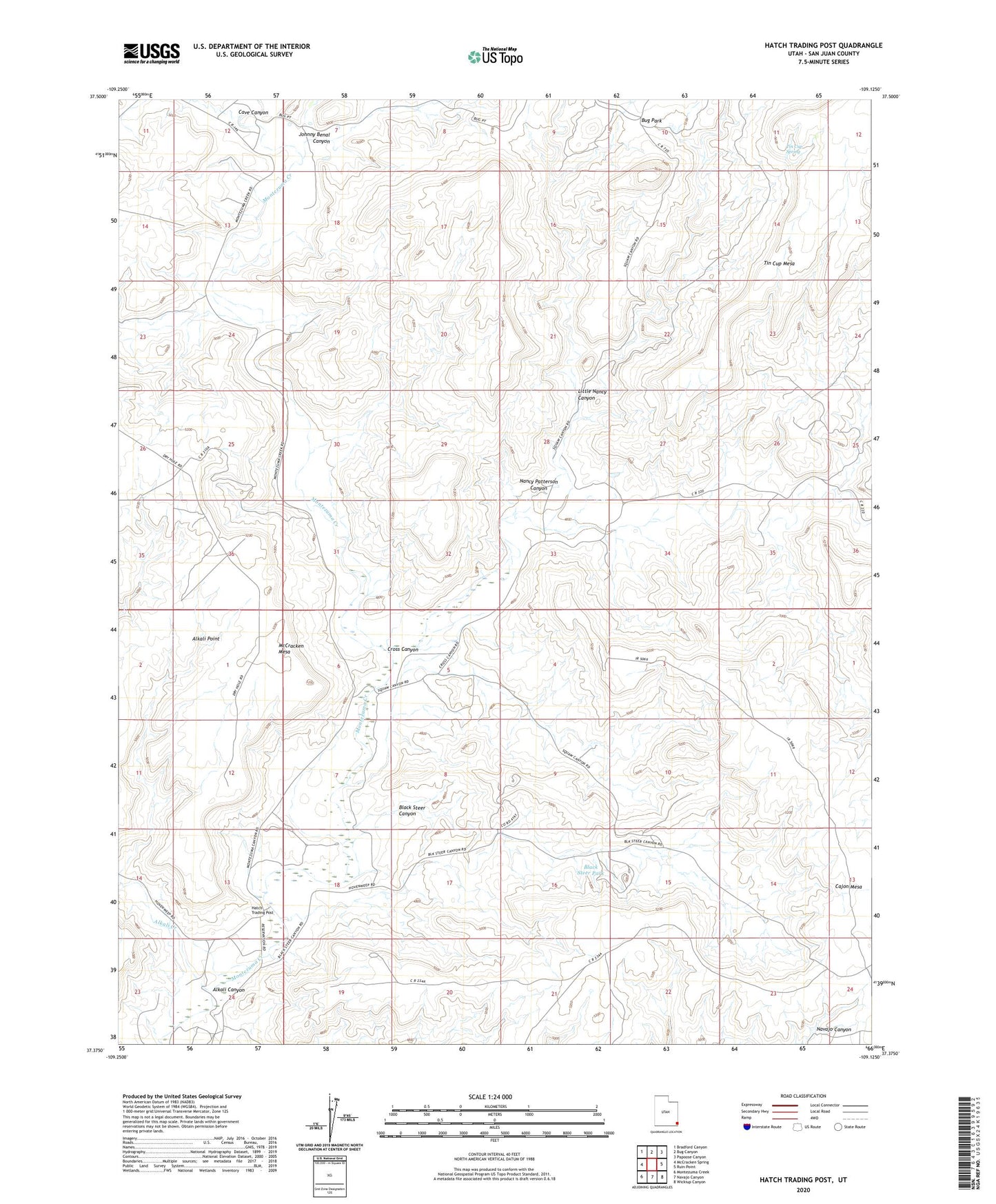
2023 topographic map quadrangle Hatch Trading Post in the state of Utah. Scale: 1:24000. Based on the newly updated USGS 7.5' US Topo map series, this map is in the following counties: San Juan. The map contains contour data, water features, and other items you are used to seeing on USGS maps, but also has updated roads and other features. This is the next generation of topographic maps. Printed on high-quality waterproof paper with UV fade-resistant inks.
Quads adjacent to this one:
West: McCracken Spring
Northwest: Bradford Canyon
North: Bug Canyon
Northeast: Papoose Canyon
East: Ruin Point
Southeast: Wickiup Canyon
South: Navajo Canyon
Southwest: Montezuma Creek
This map covers the same area as the classic USGS quad with code o37109d2.
Contains the following named places: Alkali Canyon, Alkali Creek, Black Steer Canyon, Black Steer Park, Bug Park, Cave Canyon, Cross Canyon, Hatch Trading Post, Hatch Trailer School, Little Nancy Canyon, Nancy Patterson Canyon, Perkins Ranch, Tin Cup Mesa, Tin Cup Spring