MyTopo
Woodland Utah US Topo Map
Couldn't load pickup availability
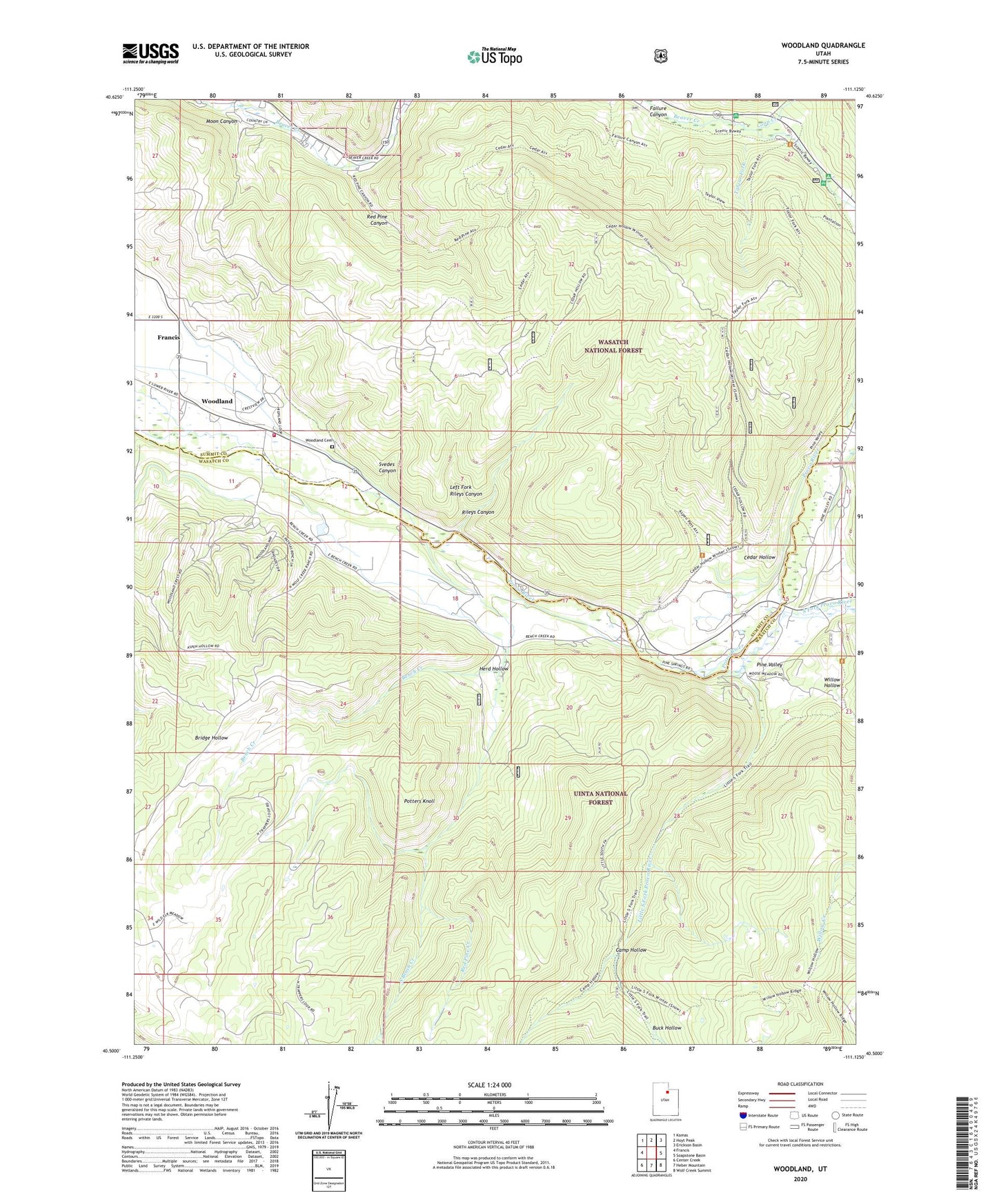
2020 topographic map quadrangle Woodland in the state of Utah. Scale: 1:24000. Based on the newly updated USGS 7.5' US Topo map series, this map is in the following counties: Wasatch, Summit. The map contains contour data, water features, and other items you are used to seeing on USGS maps, but also has updated roads and other features. This is the next generation of topographic maps. Printed on high-quality waterproof paper with UV fade-resistant inks.
Quads adjacent to this one:
West: Francis
Northwest: Kamas
North: Hoyt Peak
Northeast: Erickson Basin
East: Soapstone Basin
Southeast: Wolf Creek Summit
South: Heber Mountain
Southwest: Center Creek
Contains the following named places: Beaver Creek Campground, Bench Creek, Buck Hollow, Camp Hollow, Cedar Hollow, Coop Creek, Failure Canyon, Heber City East Division, Herd Hollow, Kamas Fish Hatchery, Left Fork Beaver Creek, Left Fork Rileys Canyon, Little South Fork Provo River, Moon Canyon, Oakcrest Camp, Pine Valley, Potters Knoll, Red Pine Canyon, Red Pine Creek, Rileys Canyon, Samak, Shingle Creek Campground, Shingle Creek Recreation Site, South Bench Creek, South Fork Provo River, South Summit Fire District - Woodland, Svedes Canyon, Taylor Fork, Taylors Fork Campground, The Church of Jesus Christ of Latter Day Saints, Willow Creek, Willow Hollow, Woodland, Woodland Cemetery, Woodland Census Designated Place