MyTopo
Wolf Creek Summit Utah US Topo Map
Couldn't load pickup availability
Also explore the Wolf Creek Summit Forest Service Topo of this same quad for updated USFS data
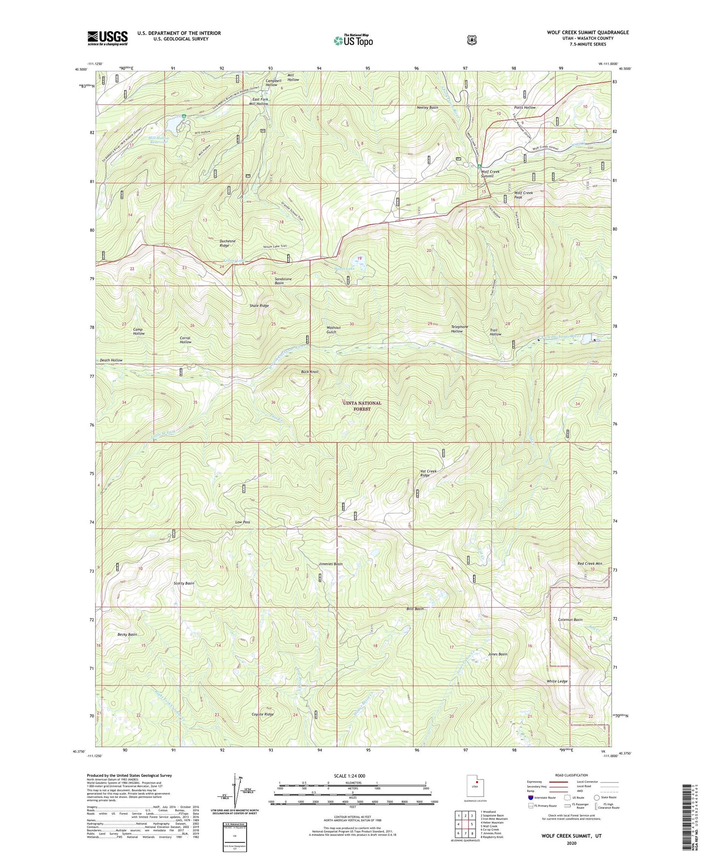
2023 topographic map quadrangle Wolf Creek Summit in the state of Utah. Scale: 1:24000. Based on the newly updated USGS 7.5' US Topo map series, this map is in the following counties: Wasatch. The map contains contour data, water features, and other items you are used to seeing on USGS maps, but also has updated roads and other features. This is the next generation of topographic maps. Printed on high-quality waterproof paper with UV fade-resistant inks.
Quads adjacent to this one:
West: Heber Mountain
Northwest: Woodland
North: Soapstone Basin
Northeast: Iron Mine Mountain
East: Wolf Creek
Southeast: Raspberry Knoll
South: Jimmies Point
Southwest: Co-op Creek
This map covers the same area as the classic USGS quad with code o40111d1.
Contains the following named places: Becky Basin, Beef Pasture, Bills Basin, Buck Knoll, Camp Hollow, Campbell Hollow, Coleman Basin, Corral Hollow, Coyote Ridge, East Fork Mill Hollow, Heart Lake, Jimmies Basin, Jones Basin, Little West Fork, Low Pass, Mill Hollow Campground, Mill Hollow Dam, Mill Hollow Granite School Center, Mill Hollow Guard Station, Mill Hollow Reservoir, Neeley Basin, Pass Creek, Red Creek Mountain, Sandstone Basin, Scotty Basin, Shale Ridge, Telephone Hollow, Trail Hollow, Vat Creek, Vat Creek Ridge, Vat Tunnel, Washout Gulch, White Ledge, Wolf Creek Campground, Wolf Creek Peak, Wolf Creek Summit, Yellow Lake