MyTopo
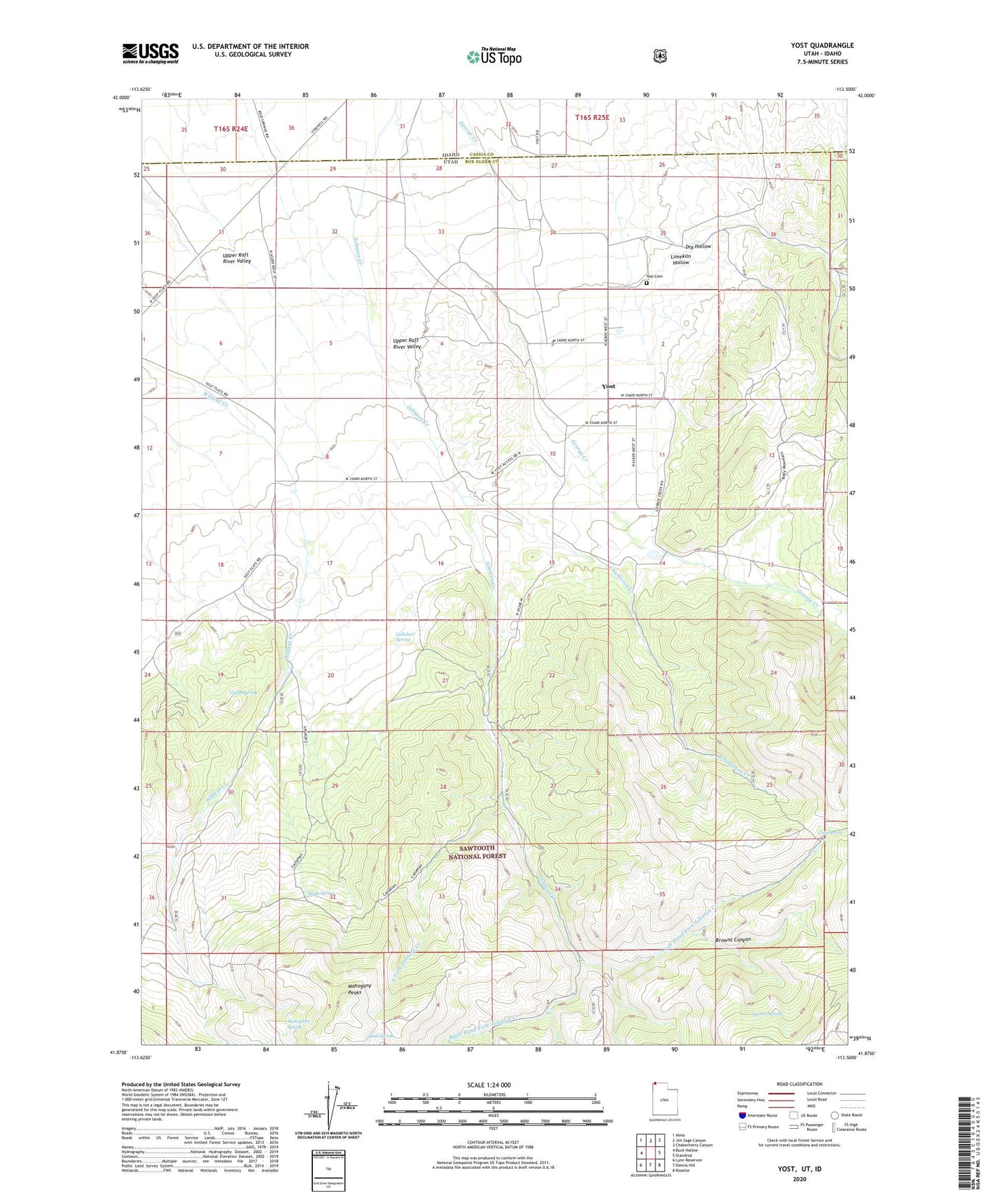
Yost Utah US Topo Map
Couldn't load pickup availability
Also explore the Yost Forest Service Topo of this same quad for updated USFS data
2023 topographic map quadrangle Yost in the state of Utah. Scale: 1:24000. Based on the newly updated USGS 7.5' US Topo map series, this map is in the following counties: Box Elder, Cassia. The map contains contour data, water features, and other items you are used to seeing on USGS maps, but also has updated roads and other features. This is the next generation of topographic maps. Printed on high-quality waterproof paper with UV fade-resistant inks.
Quads adjacent to this one:
West: Buck Hollow
Northwest: Almo
North: Jim Sage Canyon
Northeast: Chokecherry Canyon
East: Standrod
Southeast: Rosette
South: Dennis Hill
Southwest: Lynn Reservoir
This map covers the same area as the classic USGS quad with code o41113h5.
Contains the following named places: Blyth Spring, Browns Canyon, Cabin Spring, Callahan Spring, Carter Spring, Charleston Creek, Cold Spring, Dry Hollow, Left Hand Fork Johnson Creek, Limekiln Hollow, Mahogany Peaks, Mahogany Spring, Mud Spring, Right Hand Fork Johnson Creek, South Fork Johnson Creek, Upper Raft River Valley, Yost, Yost Cemetery