MyTopo
Colchester Point Vermont US Topo Map
Couldn't load pickup availability
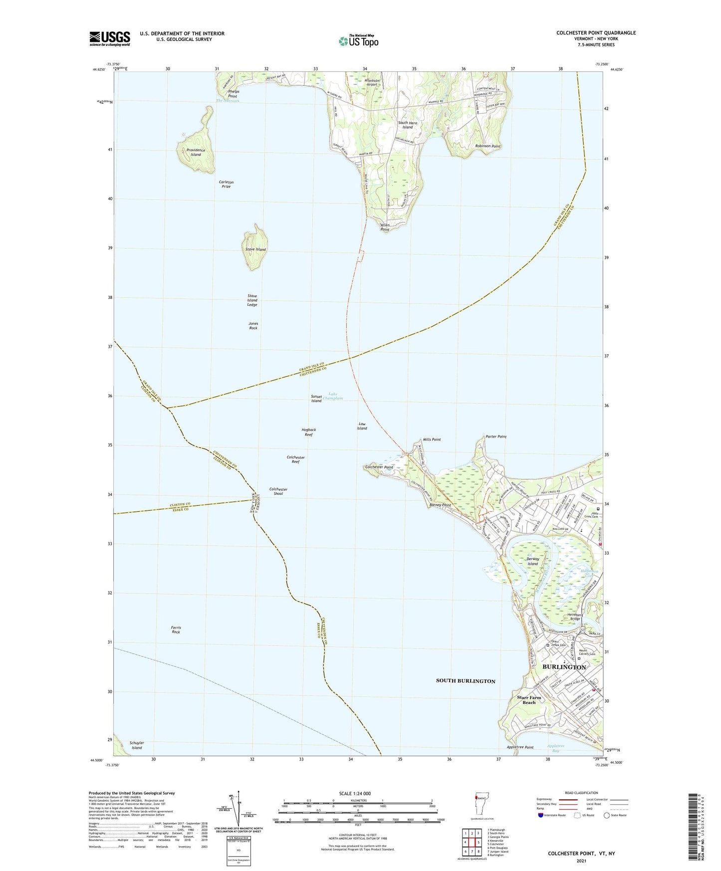
2021 topographic map quadrangle Colchester Point in the states of Vermont, New York. Scale: 1:24000. Based on the newly updated USGS 7.5' US Topo map series, this map is in the following counties: Grand Isle, Chittenden, Essex, Clinton. The map contains contour data, water features, and other items you are used to seeing on USGS maps, but also has updated roads and other features. This is the next generation of topographic maps. Printed on high-quality waterproof paper with UV fade-resistant inks.
Quads adjacent to this one:
West: Keeseville
Northwest: Plattsburgh
North: South Hero
Northeast: Georgia Plains
East: Colchester
Southeast: Burlington
South: Juniper Island
Southwest: Port Douglass
Contains the following named places: Allen Point, Allenholm Airport, Barney Point, Bernard J Leddy Park, Burlington Fire Department Station 4, Camp Hochelaga, Camp Saint Joseph, Camp Skyland, Carleton Prize, Champlain Landing Field, Colchester Point, Colchester Reef, Colchester Shoal, Derway Island, Ferris Rock, Halfmoon Cove, Heineberg Bridge, Hogback Reef, Holy Cross Camp, Holy Cross Cemetery, Holy Cross Church, John J Flynn Elementary School, Jones Rock, Lake Champlain, Law Island, Malletts Bay Fire Department, Mayes Boat Landing Ramp, Mills Point, Mount Calvary Cemetery, Ohavi Zedek Cemetery, Phelps Point, Port Kent Burlington Ferry, Porter Point, Porters Point Elementary School, Providence Island, Robinson Point, Saint Marks Youth Center, Starr Farm Beach, Stave Island, Stave Island Ledge, Stave Island Seaplane Base, Sunset Drive-In, Sunset Island, Thayer Beach, The Narrows, Winooski River