MyTopo
Georgia Plains Vermont US Topo Map
Couldn't load pickup availability
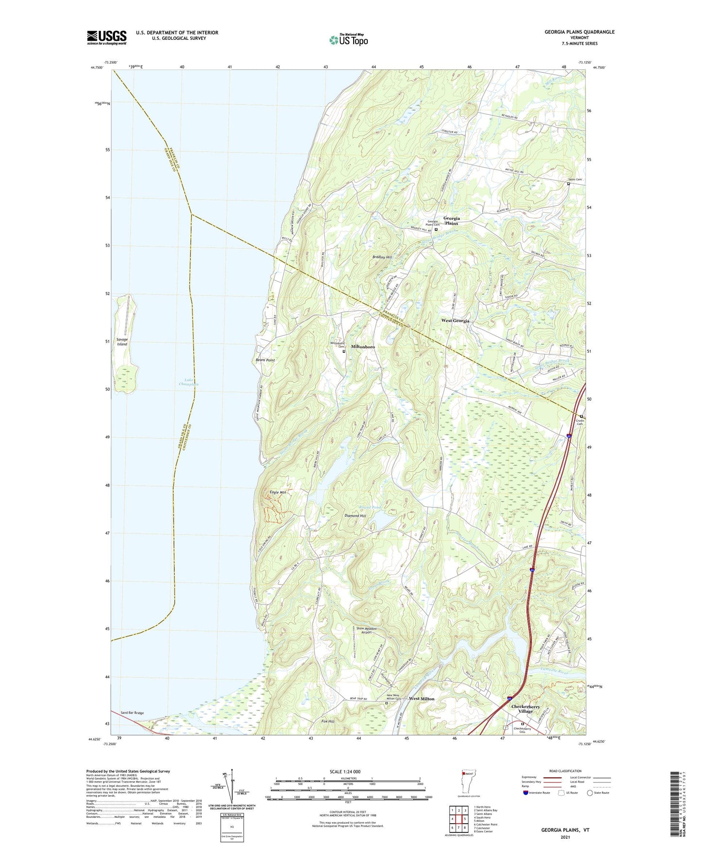
2024 topographic map quadrangle Georgia Plains in the state of Vermont. Scale: 1:24000. Based on the newly updated USGS 7.5' US Topo map series, this map is in the following counties: Chittenden, Franklin, Grand Isle. The map contains contour data, water features, and other items you are used to seeing on USGS maps, but also has updated roads and other features. This is the next generation of topographic maps. Printed on high-quality waterproof paper with UV fade-resistant inks.
Quads adjacent to this one:
West: South Hero
Northwest: North Hero
North: Saint Albans Bay
Northeast: Saint Albans
East: Milton
Southeast: Essex Center
South: Colchester
Southwest: Colchester Point
This map covers the same area as the classic USGS quad with code o44073f2.
Contains the following named places: Algonquin Camp, Beans Point, Bradley Hill, Camp Everest, Camp Rich, Camp Watson, Checkerberry Cemetery, Checkerberry Village, Cold Springs Camp, Crown Cemetery, Diamond Hill, Eagle Mountain, Eagle Mountain Camp, Fox Hill, Georgia Plains, Georgia Plains Cemetery, Long Pond, Miltonboro, Miltonboro Cemetery, New West Milton Cemetery, Old West Milton Cemetery, Peterson Dam, Round Pond, Sabin Cemetery, Sand Bar State Park, Savage Island, Savage Island Airport, School Number 8, Shaw Meadow Airport, Silvertown School, Stone Bridge Brook, Streeter Brook, The Cedars, Town of Georgia, Town of Milton, Towns Corner School, Trout Brook, West Georgia, West Milton, West Milton School, West View, ZIP Code: 05468