MyTopo
Juniper Island Vermont US Topo Map
Couldn't load pickup availability
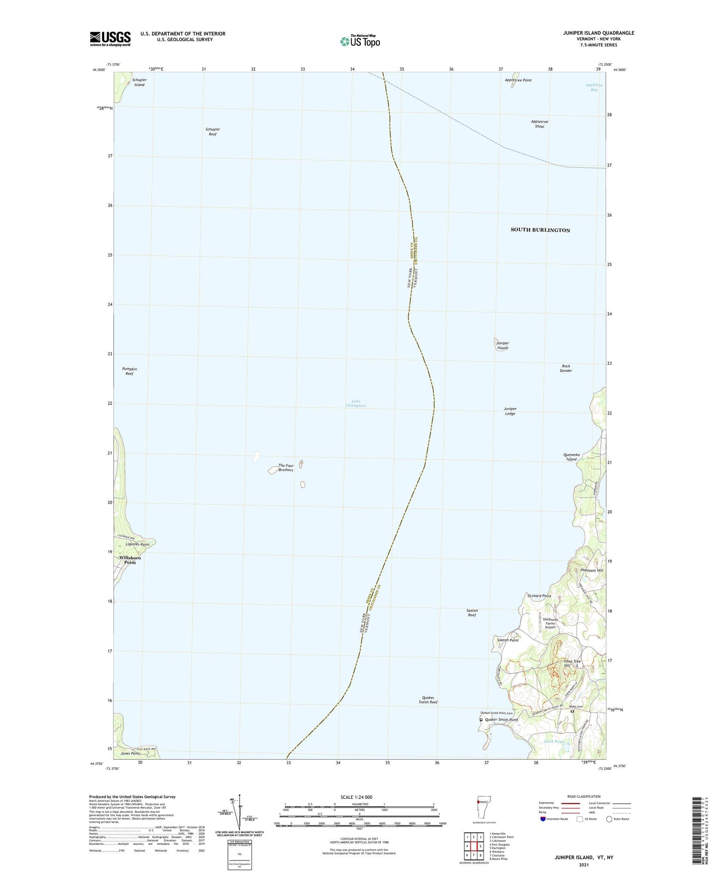
2024 topographic map quadrangle Juniper Island in the states of Vermont, New York. Scale: 1:24000. Based on the newly updated USGS 7.5' US Topo map series, this map is in the following counties: Chittenden, Essex. The map contains contour data, water features, and other items you are used to seeing on USGS maps, but also has updated roads and other features. This is the next generation of topographic maps. Printed on high-quality waterproof paper with UV fade-resistant inks.
Quads adjacent to this one:
West: Port Douglass
Northwest: Keeseville
North: Colchester Point
Northeast: Colchester
East: Burlington
Southeast: Mount Philo
South: Charlotte
Southwest: Willsboro
Contains the following named places: Appletree Bay, Appletree Point, Appletree Shoal, Burlington Ferr, City of South Burlington, Duck Pond, Jones Point, Juniper Island, Juniper Ledge, Ligonier Point, Lone Tree Hill, Orchard Point, Pheasant Hill, Pumpkin Reef, Quaker Smith Point, Quaker Smith Point Cemetery, Quaker Smith Reef, Queneska Island, Rock Dunder, Saxton Point, Saxton Reef, Schuyler Reef, Shelburne Farms Airport, Shelburne Point, The Four Brothers, Webb Cemetery