MyTopo
Danby Vermont US Topo Map
Couldn't load pickup availability
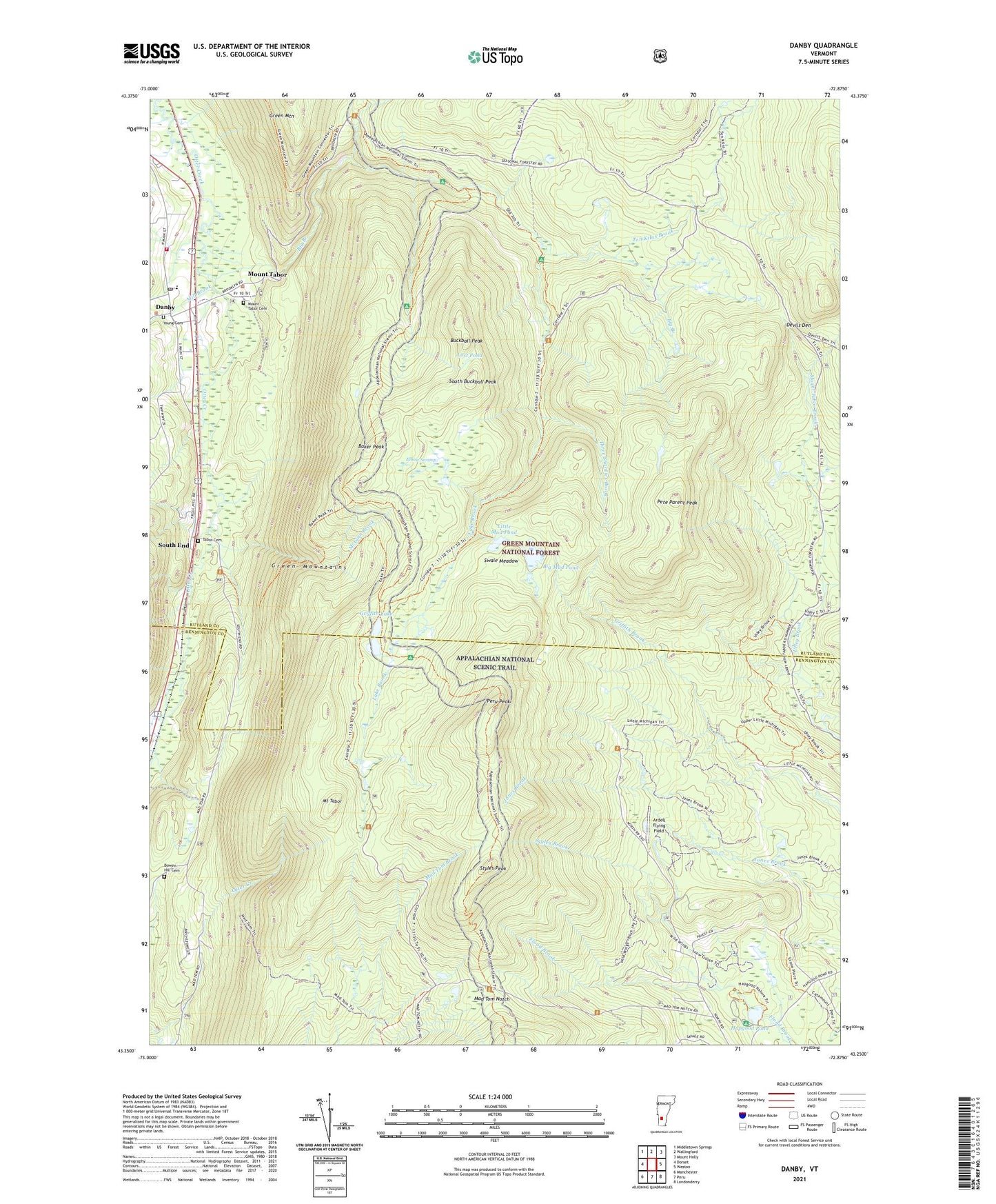
2021 topographic map quadrangle Danby in the state of Vermont. Scale: 1:24000. Based on the newly updated USGS 7.5' US Topo map series, this map is in the following counties: Rutland, Bennington. The map contains contour data, water features, and other items you are used to seeing on USGS maps, but also has updated roads and other features. This is the next generation of topographic maps. Printed on high-quality waterproof paper with UV fade-resistant inks.
Quads adjacent to this one:
West: Dorset
Northwest: Middletown Springs
North: Wallingford
Northeast: Mount Holly
East: Weston
Southeast: Londonderry
South: Peru
Southwest: Manchester
Contains the following named places: Ardell Flying Field, Baker Peak, Baker Peak Trail, Big Black Branch, Big Branch, Big Branch Picnic Grounds, Big Branch Shelter, Big Branch Wilderness, Big Mud Pond, Black Branch Recreation Site, Bowen Hill Cemetery, Buckball Peak, Currier Memorial School, Danby, Danby - Mount Tabor Volunteer Fire Department Station 1, Danby Census Designated Place, Danby Post Office, Danby Town Hall, Danby Village Historic District, Devils Den, Elbow Swamp, Emerald Lake State Forest, Griffith Lake, Griffith Shelter, Hapgood Pond, Hapgood Pond Camp and Picnic Grounds, Hapgood Pond Camping Area, Jones Brook Trail, Lake Brook, Lake Trail, Little Black Branch, Little Michigan Trail, Little Mud Pond, Long Hole, Lost Pond, Lost Pond Shelter, Mad Tom Notch, McGinn Brook, Mill Brook, Mount Tabor, Mount Tabor Brook, Mount Tabor Cemetery, Mount Tabor Town Hall, Mountain of the Lord Church, Old Job, Old Job Shelter, Old Job Trail, P.O.R.C. Winter Sports Area, Peru Peak, Peru Peak Shelter, Peru Peak Wilderness, Pete Parent Peak, S L Griffith Memorial Library, South Buckball Peak, South End, Staples Trail, Styles Brook, Styles Peak, Swale Meadow, Tabor Cemetery, Ten Kilns Brook, Three Shanties Brook, Town of Mount Tabor, Town of Peru, Utley Brook Trail, Wild Wings Ski Touring Center, Wild Wings Winter Sports Area, Young Cemetery