MyTopo
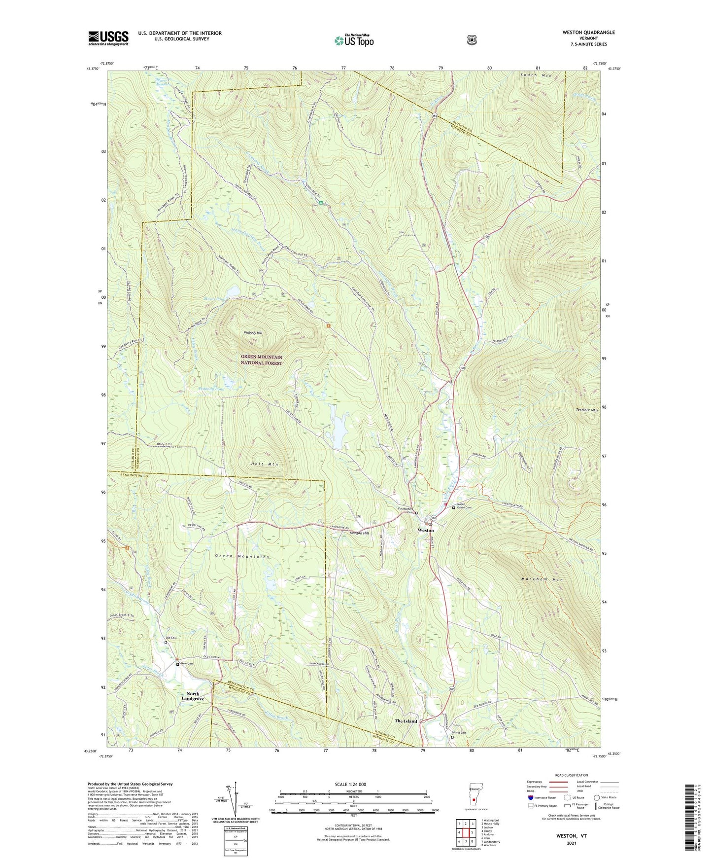
Weston Vermont US Topo Map
Couldn't load pickup availability
Also explore the Weston Forest Service Topo of this same quad for updated USFS data
2024 topographic map quadrangle Weston in the state of Vermont. Scale: 1:24000. Based on the newly updated USGS 7.5' US Topo map series, this map is in the following counties: Windsor, Bennington, Rutland, Windham. The map contains contour data, water features, and other items you are used to seeing on USGS maps, but also has updated roads and other features. This is the next generation of topographic maps. Printed on high-quality waterproof paper with UV fade-resistant inks.
Quads adjacent to this one:
West: Danby
Northwest: Wallingford
North: Mount Holly
Northeast: Ludlow
East: Andover
Southeast: Windham
South: Londonderry
Southwest: Peru
This map covers the same area as the classic USGS quad with code o43072c7.
Contains the following named places: Beaver Meadows, Farrar Park, Farrar-Mansur Museum, Forefathers Cemetery, Greendale Brook, Greendale Camp and Picnic Grounds, Griffith Brook, Holt Mountain, Island Cemetery, Jenny Coolidge Brook, Jones Brook, Landgrove School, Maple Grove Cemetery, Markham Mountain, Morgan Hill, Moses Pond, New Cemetery, North Landgrove, Old Cemetery, Old Parish Church, Peabody Hill, Peabody Pond, The Island, Town of Landgrove, Town of Weston, Villiage Inn Winter Sports Area, Wantastiquet Lake, Wantastiquet Lake Dam, Wantastiquet Trout Club, Weston, Weston Bowl Mill, Weston Census Designated Place, Weston Community Church, Weston Playhouse, Weston Post Office, Weston Priory, Weston Village Historic District, Weston Volunteer Fire Department, Wilder Memorial Library, Zion Chapel, ZIP Code: 05161