MyTopo
Pownal Vermont US Topo Map
Couldn't load pickup availability
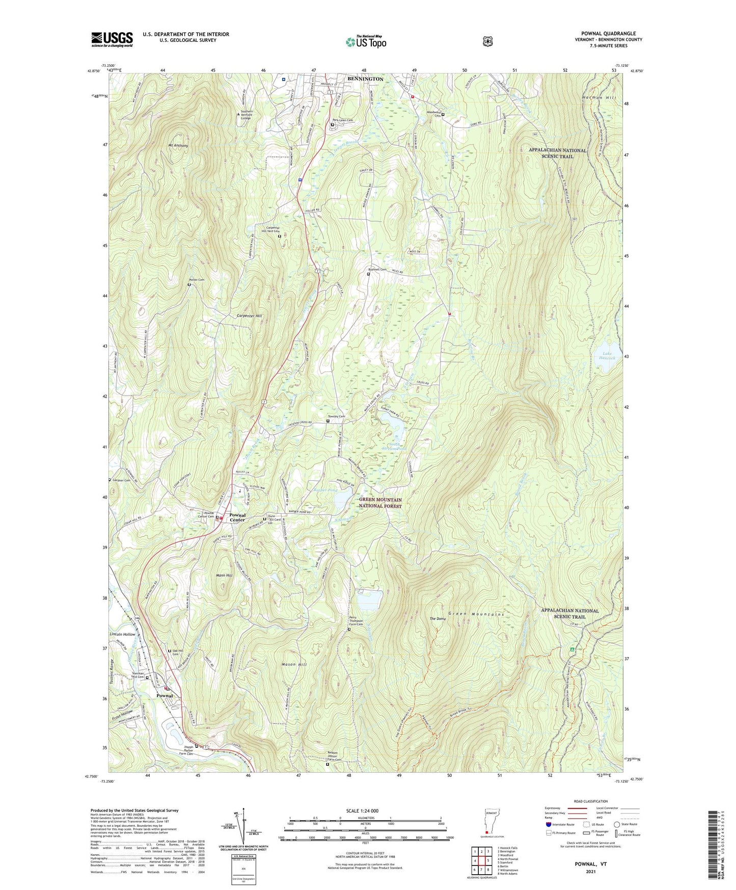
2021 topographic map quadrangle Pownal in the state of Vermont. Scale: 1:24000. Based on the newly updated USGS 7.5' US Topo map series, this map is in the following counties: Bennington. The map contains contour data, water features, and other items you are used to seeing on USGS maps, but also has updated roads and other features. This is the next generation of topographic maps. Printed on high-quality waterproof paper with UV fade-resistant inks.
Quads adjacent to this one:
Northwest: Hoosick Falls
North: Bennington
Northeast: Woodford
East: Stamford
Southeast: North Adams
South: Williamstown
Southwest: Berlin
Contains the following named places: Barber Pond, Barber Pond Dam, Barber School, Beech Street School, Bennington Census Designated Place, Bennington County Sheriff's Office, Bennington Hatchery, Bennington Municipal Forest, Bennington Rural Fire Department Company 3, Bushnell Cemetery, Bushnell School, Carpenter Hill, Carpenter Hill Yard Cemetery, Christian and Missionary Alliance Church, Col Seth Warner Camp, Cozy Meadow Mobile Home Park, Downs Cemetery, Dunn - Ell Card Lot, Ellis Mine Hollow, Frost Hollow, Gardner Cemetery, Harmon Hill, Hidden Pasture Farm, Hill Top Farm, Holy Cross Novitiate, Jewett Brook, Joseph Barber Farm Cemetery, Ladd Brook, Lake Hancock, Lincoln Hollow, Mann Hill, Maple Grove School, Mason Hill, Mount Anthony, Oak Hill Cemetery, Oak Hill School, Park Lawn Cemetery, Perry Thompson Farm Cemetery, Pine Hollow Campground, Potter Cemetery, Pownal, Pownal Census Designated Place, Pownal Center, Pownal Center Cemetery, Pownal Center Census Designated Place, Pownal Center Fire Station, Pownal Center Town Hall, Pownal Elementary School, Pownal Fire Protective Association, Pownal Post Office, Pownal Rescue Squad, Pownal Valley Fire Department - Central Station, Pownal Valley Fire Department - East Station, Reuben Jepson Farm Cemetery, Roaring Branch, Saint Joseph College, Shadowbrook Farm, Shady Acres Campground, Sherman Yard Cemetery, Solomon Wright Library, South Stream, South Stream Dam, South Stream Pond, South Stream Waterfowl Area, Southern Vermont College, Southern Vermont College Library, Southwest Vermont Supervisory Union, Southwestern Vermont Medical Center, Southwestern Vermont Medical Center Medical Library, The Dome, The Elbow, Thendara Camp, Thompsons Pond, Thompsons Pond Upper Dam, Town of Pownal, Towsley Cemetery, Union Church, Varney School, Woodward Cemetery, ZIP Codes: 05201, 05261