MyTopo
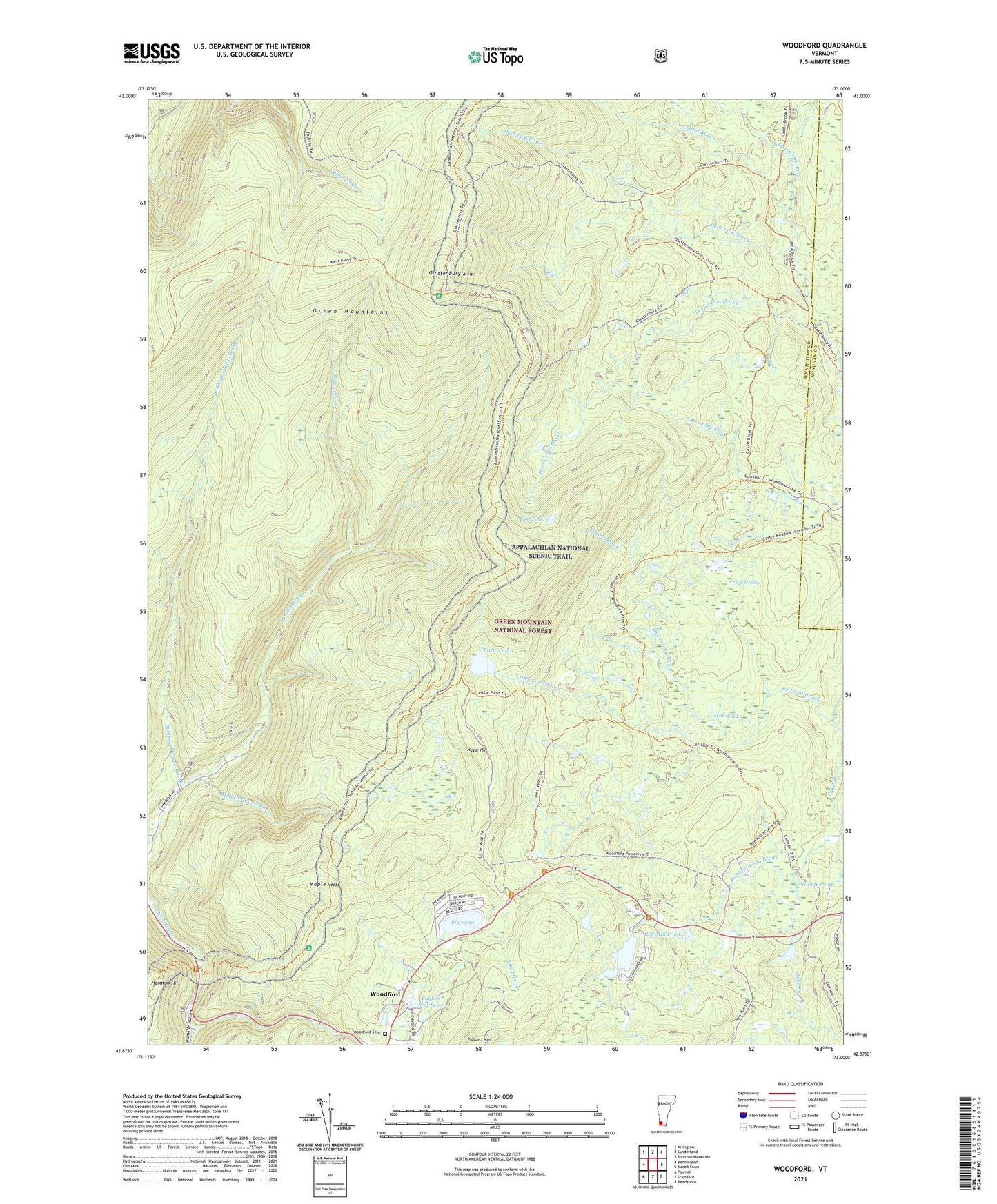
Woodford Vermont US Topo Map
Couldn't load pickup availability
Also explore the Woodford Forest Service Topo of this same quad for updated USFS data
2024 topographic map quadrangle Woodford in the state of Vermont. Scale: 1:24000. Based on the newly updated USGS 7.5' US Topo map series, this map is in the following counties: Bennington, Windham. The map contains contour data, water features, and other items you are used to seeing on USGS maps, but also has updated roads and other features. This is the next generation of topographic maps. Printed on high-quality waterproof paper with UV fade-resistant inks.
Quads adjacent to this one:
West: Bennington
Northwest: Arlington
North: Sunderland
Northeast: Stratton Mountain
East: Mount Snow
Southeast: Readsboro
South: Stamford
Southwest: Pownal
This map covers the same area as the classic USGS quad with code o42073h1.
Contains the following named places: Adams Reservoir, Adams Reservoir Dam, Atwood Trail, Bickford Hollow Brook, Big Pond, Billings Pond, Blind Brook, Bolles Brook, Bugbee Mill Pond, Bugbee Pond Dam, Castle Meadow, Deer Cabin Brook, Deer Lick Brook, Dunville Hollow, Fay Fuller Camp, Glastenbury Camp, Glastenbury Mountain, Glastenbury Mountain Lookout, Glastenbury Wilderness, Greenwood Lodge and Tent Sites, Hagar Hill, Hell Hollow Brook, Little Pond, Little Pond Brook, Lost Pond, Maple Hill, Mellville Nanheim Shelter, Mill Pond, Mill Pond Brook, Molly Stark Trail, Prospect Mountain Ski Center, Red Mill Brook Campground, Red Mill Brook Camping Area, Red Mill Pond, Red Mill Pond Brook, Redfield Brook, Ricker Dam, South Pond Brook, Stamford Stream, Town of Glastenbury, Town of Woodford, Union Church, Woodford, Woodford Cemetery, Woodford State Park, ZIP Code: 05262