MyTopo
Richford Vermont US Topo Map
Couldn't load pickup availability
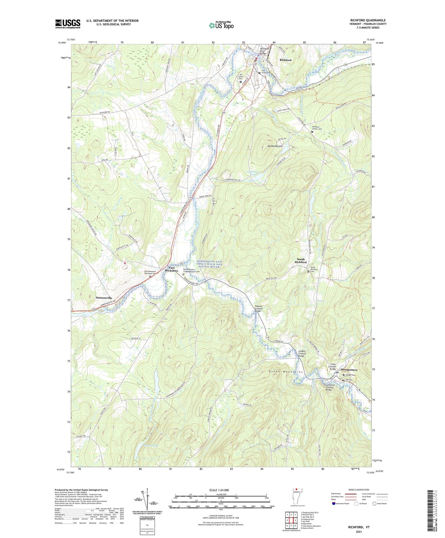
2021 topographic map quadrangle Richford in the state of Vermont. Scale: 1:24000. Based on the newly updated USGS 7.5' US Topo map series, this map is in the following counties: Franklin. The map contains contour data, water features, and other items you are used to seeing on USGS maps, but also has updated roads and other features. This is the next generation of topographic maps. Printed on high-quality waterproof paper with UV fade-resistant inks.
Quads adjacent to this one:
West: Enosburg Falls
Northwest: Enosburg Falls OE N
North: Richford OE N
Northeast: Jay Peak OE N
East: Jay Peak
Southeast: Hazens Notch
South: Cold Hollow Mountains
Southwest: Bakersfield
Contains the following named places: Adams Pond, All Saints Cemetery, Arvin A Brown Public Library, Berkshire Fire Department, Berkshire Municipal Forest, Black Falls Brook, Comstock Covered Bridge, Downtown Richford Historic District, East Berkshire, East Berkshire Congregational Cemetery, East Berkshire Congregational Church, East Berkshire Episcopal Cemetery, Enosburg Town Forest, Fuller Covered Bridge, Guillmettes Pond, Hardwood Hill, Hopkins Covered Bridge, Longley Covered Bridge, Loveland Brook, Missisquoi and Trout Wild and Scenic River, Missisquoi River Bridge, Montgomery, Montgomery Post Office, North Branch Missisquoi River, Nutting Corners, Old Cemetery, Richford, Richford Census Designated Place, Richford Center Cemetery, Richford Elementary School, Richford Fire Department, Richford Junior / Senior High School, Richford Post Office, Richford Town Hall, Saint Bartholomews Episcopal Church, Samsonville, South Richford, South Richford Cemetery, Town of Enosburgh, Trout River, Troy Street Cemetery, Village Cemetery, West Hill Brook, Whittaker Brook, ZIP Codes: 05447, 05476