MyTopo
Jay Peak Vermont US Topo Map
Couldn't load pickup availability
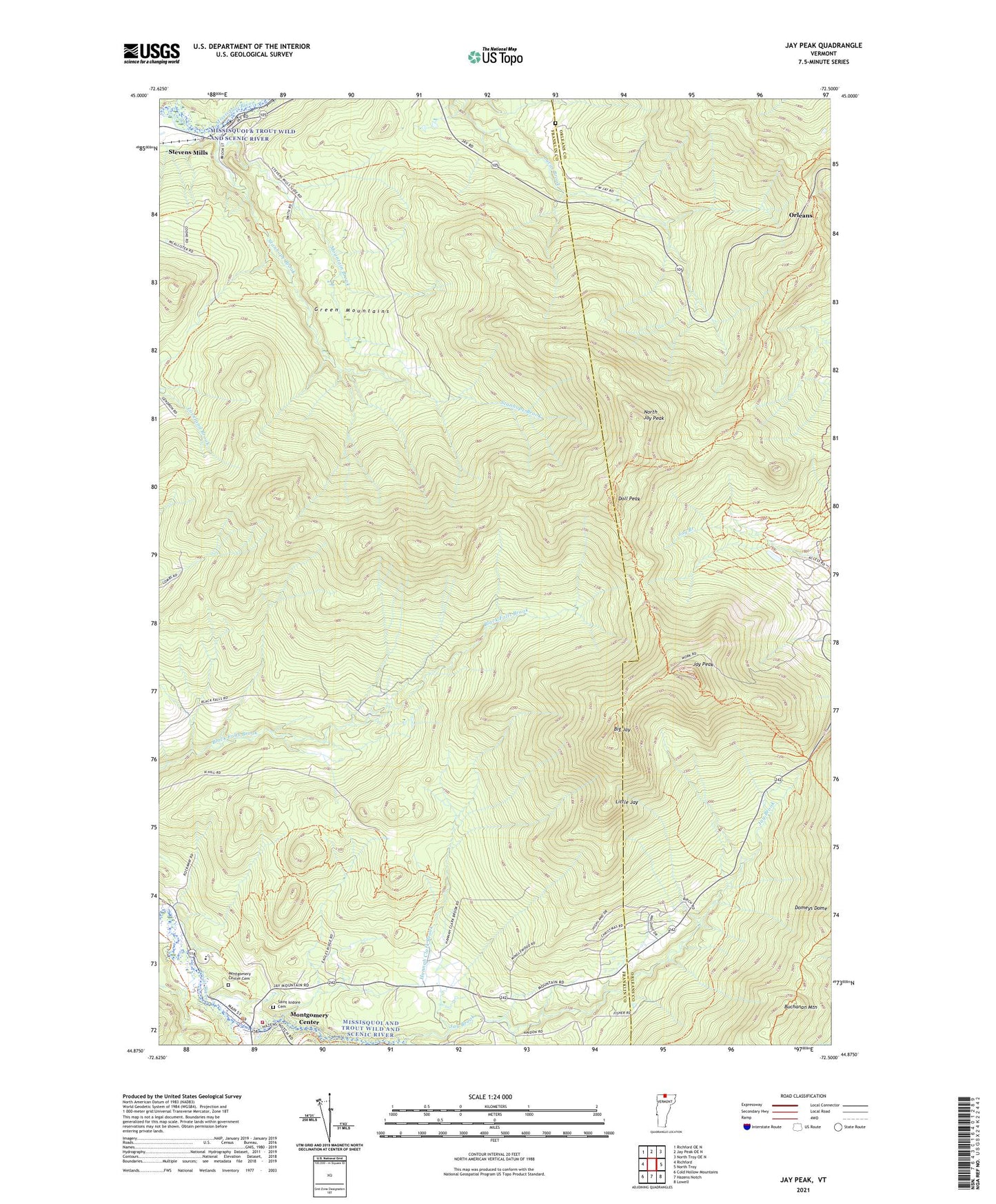
2024 topographic map quadrangle Jay Peak in the state of Vermont. Scale: 1:24000. Based on the newly updated USGS 7.5' US Topo map series, this map is in the following counties: Franklin, Orleans. The map contains contour data, water features, and other items you are used to seeing on USGS maps, but also has updated roads and other features. This is the next generation of topographic maps. Printed on high-quality waterproof paper with UV fade-resistant inks.
Quads adjacent to this one:
West: Richford
Northwest: Richford OE N
North: Jay Peak OE N
Northeast: North Troy OE N
East: North Troy
Southeast: Lowell
South: Hazens Notch
Southwest: Cold Hollow Mountains
This map covers the same area as the classic USGS quad with code o44072h5.
Contains the following named places: Big Jay, Buchanan Mountain, Doll Peak, Hannah Clark Brook, Hazens Notch Ski Touring Center, Jay Brook, Jay Camp, Jay Peak, Jay State Forest, Laura Woodward Camp, Little Jay, Montgomery Center, Montgomery Center Cemetery, Montgomery Center Post Office, Montgomery Elementary School, Montgomery Fire Department, Montgomery Rescue Squad, Mountain Brook, North Jay Peak, Saint Isadore Parish Hall, Saint Isidore Cemetery, South Branch Trout River, Stanhope Brook, Stevens Mills, Town of Richford, Wade Brook, West Jay Cemetery