MyTopo
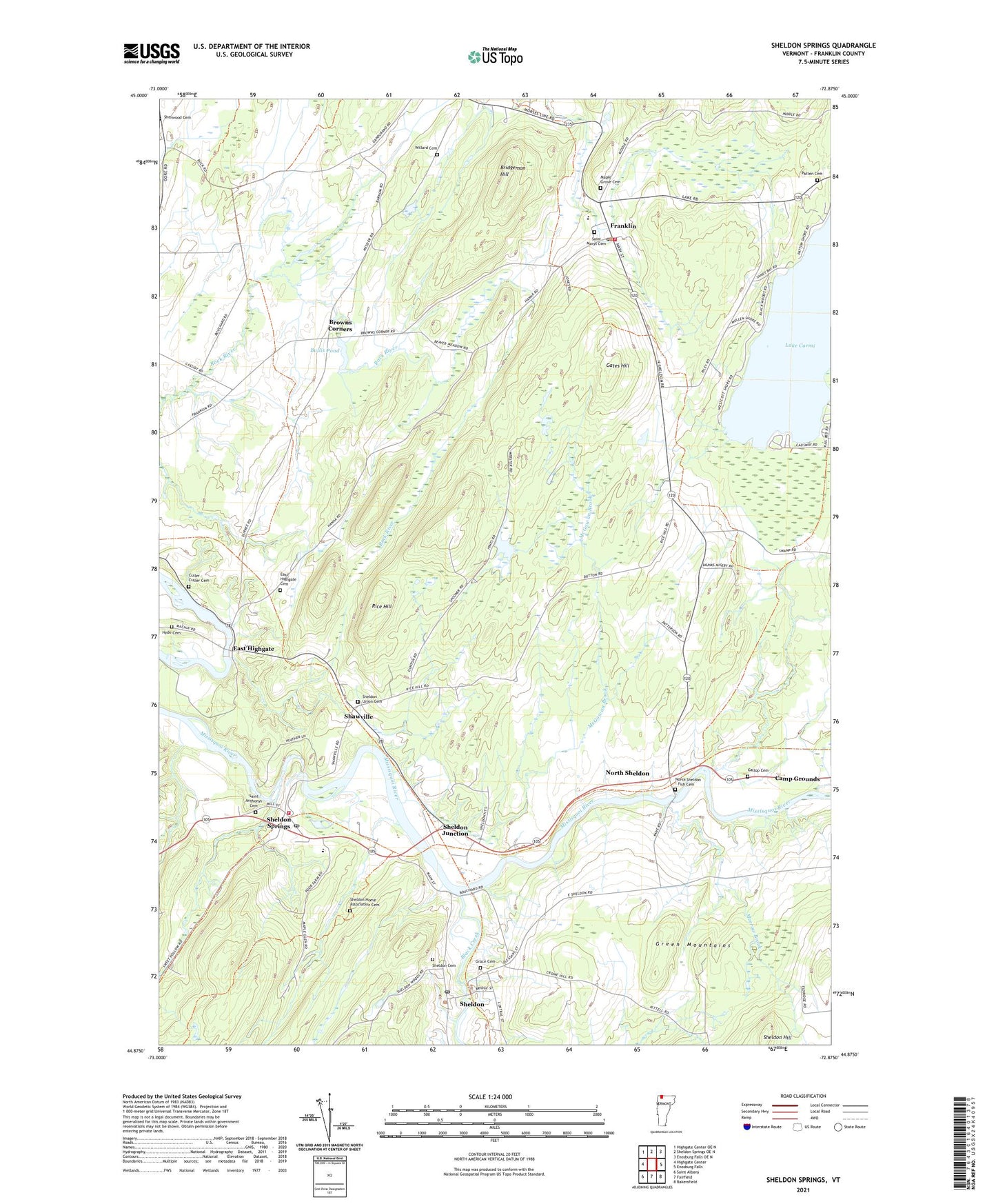
Sheldon Springs Vermont US Topo Map
Couldn't load pickup availability
2021 topographic map quadrangle Sheldon Springs in the state of Vermont. Scale: 1:24000. Based on the newly updated USGS 7.5' US Topo map series, this map is in the following counties: Franklin. The map contains contour data, water features, and other items you are used to seeing on USGS maps, but also has updated roads and other features. This is the next generation of topographic maps. Printed on high-quality waterproof paper with UV fade-resistant inks.
Quads adjacent to this one:
West: Highgate Center
Northwest: Highgate Center OE N
North: Sheldon Springs OE N
Northeast: Enosburg Falls OE N
East: Enosburg Falls
Southeast: Bakersfield
South: Fairfield
Southwest: Saint Albans
Contains the following named places: Black Creek, Bridgeman Hill, Browns Corners, Bullis Pond, Bullis Pond Dam, Camp Grounds, Culler - Cutler Cemetery, East Highgate, East Highgate Cemetery, Forest Hill School, Franklin, Franklin Central School, Franklin Post Office, Franklin Volunteer Fire Department, Gallop Cemetery, Gates Hill, Grace Cemetery, Grace Church, Haston Library, Hyde Cemetery, Lake Carmi, Maple Grove Cemetery, McGowan Brook, Morrow Brook, New Testament Christian Academy, North Sheldon, North Sheldon - Fish Cemetery, Patten Camp, Patten Cemetery, Patton Cemetery, Pomeroy School, Rice Hill, Rice Hill School, Saint Anthonys Cemetery, Saint Marys Cemetery, Shawville, Sheldon, Sheldon Cemetery, Sheldon Elementary School, Sheldon Fire Station, Sheldon Hill, Sheldon Home Association Cemetery, Sheldon Junction, Sheldon Post Office, Sheldon Springs, Sheldon Springs Dam, Sheldon Springs Post Office, Sheldon Union Cemetery, Town of Franklin, Town of Sheldon, Union Cemetery, Willard Cemetery, ZIP Codes: 05457, 05483, 05485