MyTopo
Fairfield Vermont US Topo Map
Couldn't load pickup availability
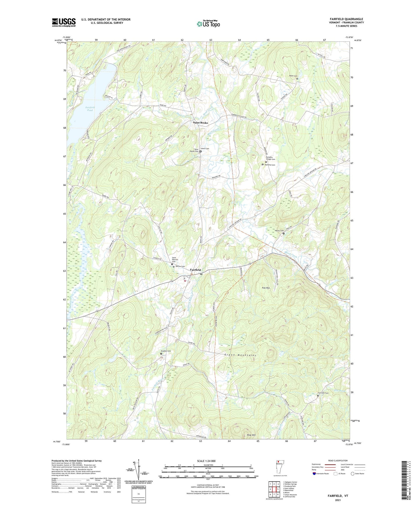
2024 topographic map quadrangle Fairfield in the state of Vermont. Scale: 1:24000. Based on the newly updated USGS 7.5' US Topo map series, this map is in the following counties: Franklin. The map contains contour data, water features, and other items you are used to seeing on USGS maps, but also has updated roads and other features. This is the next generation of topographic maps. Printed on high-quality waterproof paper with UV fade-resistant inks.
Quads adjacent to this one:
West: Saint Albans
Northwest: Highgate Center
North: Sheldon Springs
Northeast: Enosburg Falls
East: Bakersfield
Southeast: Jeffersonville
South: Gilson Mountain
Southwest: Milton
This map covers the same area as the classic USGS quad with code o44072g8.
Contains the following named places: Barlow Cemetery, Bradley Cemetery, Callan School, Creek School, Dead Creek, Diamond Cemetery, Elm Brook, Elm Brook State Wildlife Management Area, Fairfield, Fairfield Center School, Fairfield Fire Department, Fairfield Pond, Fairfield Post Office, Fairfield River, Fairfield Station, Fairfield Swamp Dam, Fairview Cemetery, Fox Hill, Franklin County, Gould School, Kirley Cemetery, Leach Cemetery, Lost Nation School, McCarty School, Morey Cemetery, Pine Hill, Pumpkin Village Cemetery, Pumpkin Village School, Saint Patricks Cemetery, Saint Patricks Church, Saint Rocks, Saint Rocks Cemetery, School Number 6, Soule School, Town of Fairfield, Waite Cemetery, ZIP Codes: 05448, 05455