MyTopo
Saint Albans Vermont US Topo Map
Couldn't load pickup availability
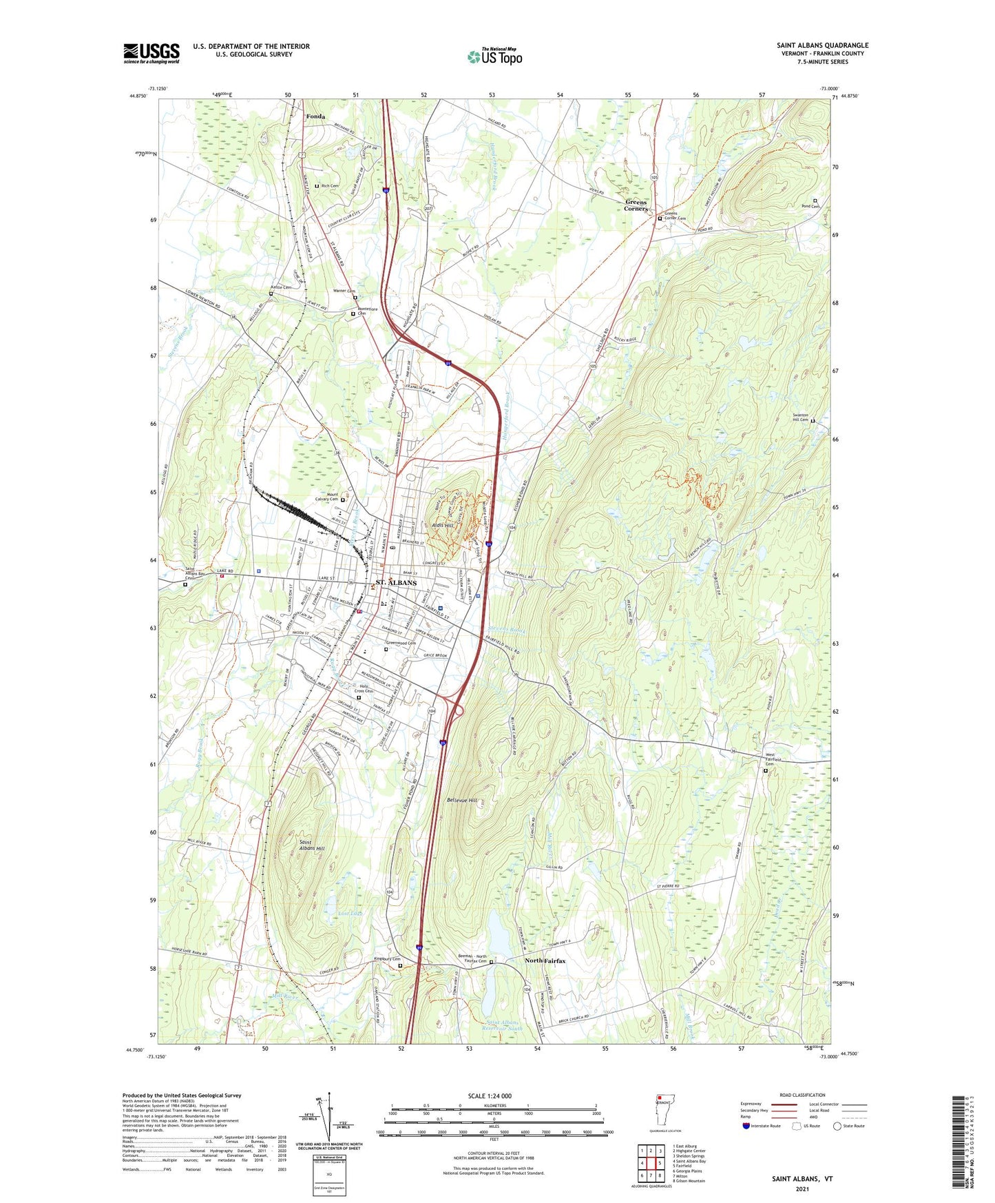
2024 topographic map quadrangle Saint Albans in the state of Vermont. Scale: 1:24000. Based on the newly updated USGS 7.5' US Topo map series, this map is in the following counties: Franklin. The map contains contour data, water features, and other items you are used to seeing on USGS maps, but also has updated roads and other features. This is the next generation of topographic maps. Printed on high-quality waterproof paper with UV fade-resistant inks.
Quads adjacent to this one:
West: Saint Albans Bay
Northwest: East Alburg
North: Highgate Center
Northeast: Sheldon Springs
East: Fairfield
Southeast: Gilson Mountain
South: Milton
Southwest: Georgia Plains
This map covers the same area as the classic USGS quad with code o44073g1.
Contains the following named places: Aldis Hill, Aldis Hill Park, Amcare Ambulance Service, Barlow Saint School, Barlow Street Playground, Beeman - North Fairfax Cemetery, Bellevue Hill, Bellow Free Academy Union High School, Brodeur Dairy Farm, Champlain Christian Academy, Champlain Country Club, City of Saint Albans, Collins-Perley Sports Center, Community College of Vermont, Cooley Cemetery, Coote Field, Elm Saint School, Fairfield Saint School, Fairfield Swamp State Wildlife Management Area, First Baptist Church, First Congregational Church, Fonda, Franklin Central Supervisory Union, Franklin County Courthouse, Franklin County Rod and Gun Club, Franklin County Sheriff's Office, Greens Corner Cemetery, Greens Corners, Greenwood Cemetery, Hard'ack Recreation Area, Hathaways Tavern, Highgate Shopping Plaza Shopping Center, Hill Farm Estates, Holy Angel School, Holy Angels Church, Holy Cross Cemetery, Holyoke Farm, Houghton Park, Kattle Cemetery, Kingsbury Cemetery, Lost Lake, Merrill Four Corners, Milton Baptist Fellowship Church, Montefiore Cemetery, Mount Calvary Cemetery, Nazarene Church, North Fairfax, Northwestern Medical Center, Northwestern Medical Center Information Center, Pathways Academy, Pond Cemetery, Rich Cemetery, Saint Albans, Saint Albans Air Force Station, Saint Albans Bay Cemetery, Saint Albans Chamber of Commerce, Saint Albans City Fire Department, Saint Albans City Hall, Saint Albans City School, Saint Albans Drive-In, Saint Albans Free Library, Saint Albans Hill, Saint Albans Historic District, Saint Albans Historical Museum, Saint Albans Municipal Forest, Saint Albans Police Department, Saint Albans Post Office, Saint Albans Reservoir, Saint Albans Reservoir North, Saint Albans Reservoir South, Saint Albans Shopping Center, Saint Albans Town Educational Center, Saint Albans Town Industrial Park, Saint Albans Town Volunteer Fire Department, Saint Lukes Episcopal Church, Saint Marys Parish Church, Saint Pauls United Methodist Church, St. Albans North Reservoir Dam, St. Albans South Reservoir Dam, State Garage Site Heliport, Swamp School, Swanton Hill Cemetery, Taylor Park, Vermont State Police Troop A Saint Albans Barracks, Warner Cemetery, West Fairfield Cemetery, WLFE-FM (Saint Albans), WWSR-AM (Saint Albans), ZIP Code: 05478