MyTopo
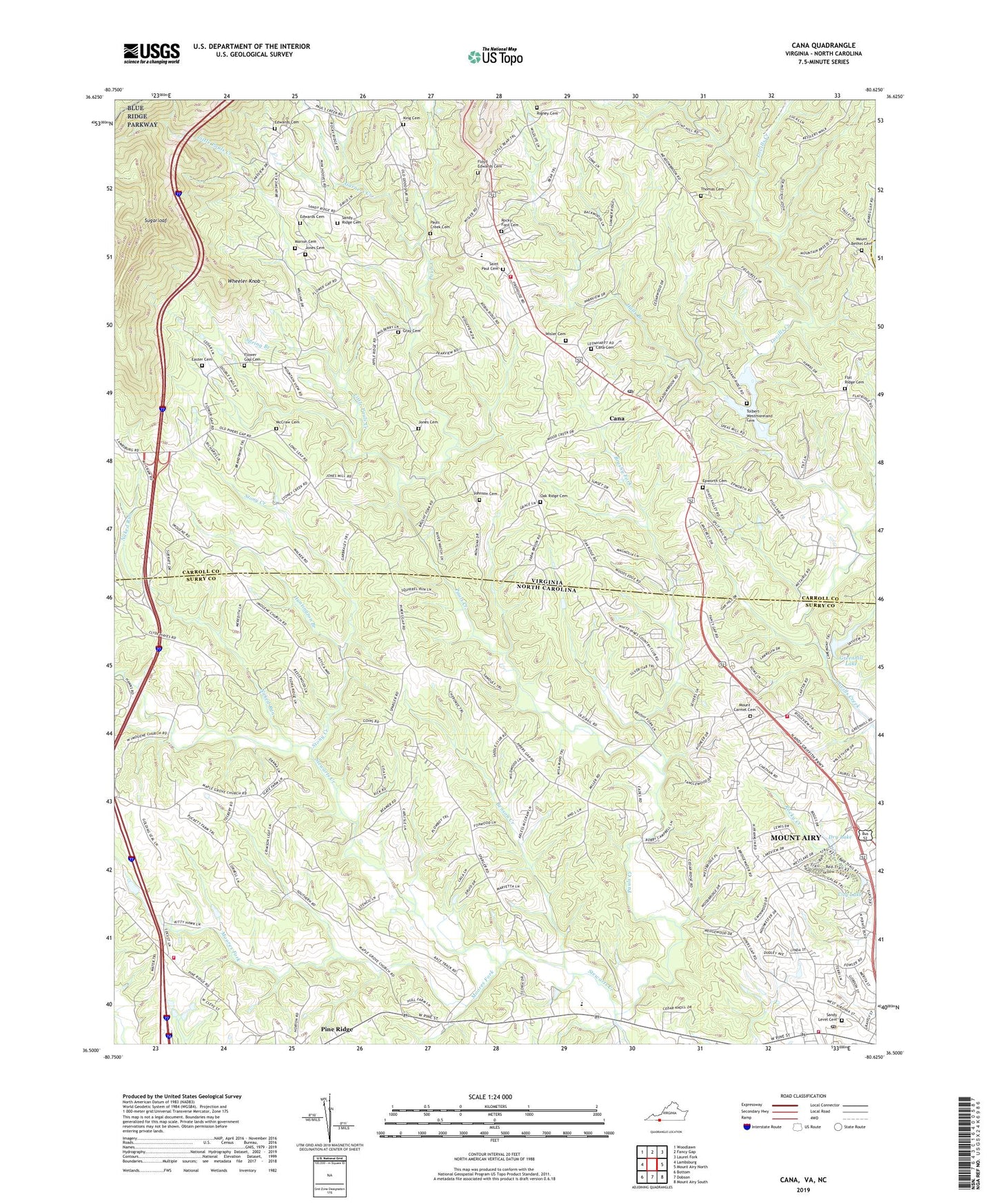
Cana Virginia US Topo Map
Couldn't load pickup availability
2019 topographic map quadrangle Cana in the states of Virginia, North Carolina. Scale: 1:24000. Based on the newly updated USGS 7.5' US Topo map series, this map is in the following counties: Carroll, Surry, Patrick. The map contains contour data, water features, and other items you are used to seeing on USGS maps, but also has updated roads and other features. This is the next generation of topographic maps. Printed on high-quality waterproof paper with UV fade-resistant inks.
Quads adjacent to this one:
West: Lambsburg
Northwest: Woodlawn
North: Fancy Gap
Northeast: Laurel Fork
East: Mount Airy North
Southeast: Mount Airy South
South: Dobson
Southwest: Bottom
Contains the following named places: Alpine, Antioch Baptist Church, Benson Creek, Bledsoe Creek, Brushy Fork, Cana, Cana Baptist Church, Cana Cemetery, Cana Census Designated Place, Cana Post Office, Cana Volunteer Fire Department, Cana Volunteer Rescue Squad, City Lake, Dowells Grove Church, Dry Lake, Easter Cemetery, Edwards Cemetery, Epworth Cemetery, Epworth Church, Fancy Gap District, Flat Ridge Cemetery, Flat Ridge Church, Flower Gap Cemetery, Flowers Gap Church, Floyd Edwards Cemetery, Franklin Community Volunteer Fire Department, Franklin Community Volunteer Fire Department Station 2, Garners Creek, Gray Cemetery, Greenhill Lake, Halls Branch, Hay Stack, Huntington Branch, Imogene Church, Imogene School, J Sam Gentry Middle School, Johnson Cemetery, Jones Cemetery, Jones Temple, King Cemetery, Little Pauls Creek, Lovills Creek Church, Maple Grove Church, Marion Cemetery, McCraw Cemetery, Midway Church, Moores Fork, Mount Bethel Cemetery, Mount Bethel Church, Mount Carmel Baptist Church, Mount Carmel Cemetery, Mount View Church, Naked Run, New Bethel Church, North Surry High School, Oak Ridge Cemetery, Oak Ridge Church, Pauls Creek, Pauls Creek Baptist Church, Pauls Creek Cemetery, Pauls Creek Church, Pine Ridge School, Pine Ridge Volunteer Fire Department, Rigney Cemetery, Rocky Ford Cemetery, Rocky Ford Church, Saint Andrews Church, Saint Paul Cemetery, Saint Paul Church of the Brethren, Saint Paul School, Sandy Level Cemetery, Sandy Ridge Cemetery, Sandy Ridge Church, Spring Branch, Stony Creek, Sugarloaf, Tabernacle Church, Thomas Cemetery, Toast, Toast Post Office, Tolbert-Westmoreland Cemetery, Township of Stewarts Creek, Westwood Industrial Park, Westwood Park, Wheeler Knob, Wisler Cemetery, Zion Baptist Church, ZIP Code: 24317