MyTopo
Mount Airy North North Carolina US Topo Map
Couldn't load pickup availability
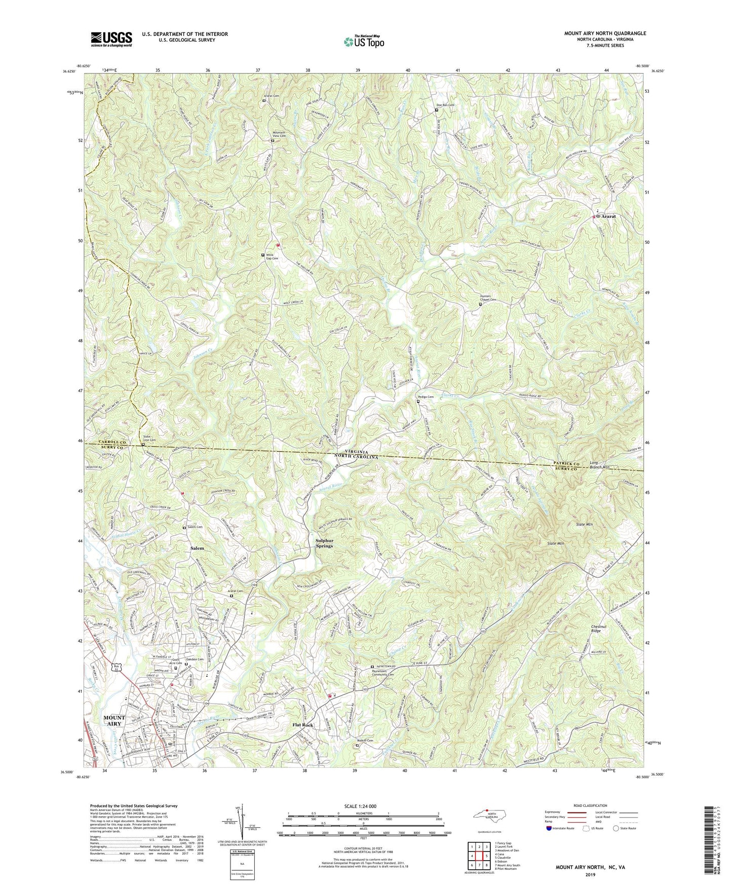
2022 topographic map quadrangle Mount Airy North in the states of Virginia, North Carolina. Scale: 1:24000. Based on the newly updated USGS 7.5' US Topo map series, this map is in the following counties: Surry, Patrick, Carroll. The map contains contour data, water features, and other items you are used to seeing on USGS maps, but also has updated roads and other features. This is the next generation of topographic maps. Printed on high-quality waterproof paper with UV fade-resistant inks.
Quads adjacent to this one:
West: Cana
Northwest: Fancy Gap
North: Laurel Fork
Northeast: Meadows of Dan
East: Claudville
Southeast: Pilot Mountain
South: Mount Airy South
Southwest: Dobson
Contains the following named places: Ararat, Ararat Cemetery, Ararat Church, Ararat Post Office, Ararat Rescue Squad, Ararat Volunteer Fire Department Station A Headquarters, Ararat Volunteer Fire Department Station B, Birds Branch, Blue Ridge Elementary School, Blue Ridge Tabernacle, Blue Ridge Volunteer Rescue Squad, Bright Leaf Drive-In, Center Church, Champ Creek, Chestnut Ridge, Chestnut Ridge Church, City of Mount Airy, Clarks Creek, Combstown, Doe Run Cemetery, Doe Run Church, Doe Run Creek, Double Spring Branch, Dry Run, East Fork Johnson Creek, Flat Rock, Flat Rock Baptist Church, Flat Rock Census Designated Place, Flat Rock Elementary, Flat Rock Quarry, Flippin Church, Four Way Volunteer Fire Department Headquarters, Fourway Volunteer Fire Department Wards Gap Station, Friendly Tabernacle, God's Acre Cemetery, Gospel Mission, Grogen Branch, Hunter Chapel, Hunters Chapel Cemetery, Johnson Creek, Jones Church, Jones Elementary School, King Noahs Branch, Kings Run, Koners Grove Church, Long Branch, Long Branch Mountain, Midkiff Cemetery, Mire Branch, Mount Airy Annex Post Office, Mount Airy Fire Department Station 2, Mount Airy High School, Mount Airy Junior High School, Mount Airy Quarry, Mount Airy Rescue Squad, Mount Ararat Church, Mount Bethel School, Mount Calvary Church, Mountain View Cemetery, Mountain View Church, Oakdale Cemetery, Owens Branch, Payne's Chapel Baptist Church, Paynetown Community Cemetery, Pedigo Cemetery, Pleasant View Church, Raven Rock Church, Reeves Community Center, Riverside Park, Rocky Creek, Rye Stack Branch, Salem, Salem Baptist Church, Salem Cemetery, Samuels Grove Church, School House Creek, Slate Mountain, Slate Mountain Baptist Church, State Line Cemetery, Stateline Church, Sulphur Springs, Sun Run, The Hollow, Township of Mount Airy, Veterans Memorial Park, Wards Gap Church, Willis Gap Cemetery, Willis Gap Church, ZIP Code: 24053