MyTopo
Bottom North Carolina US Topo Map
Couldn't load pickup availability
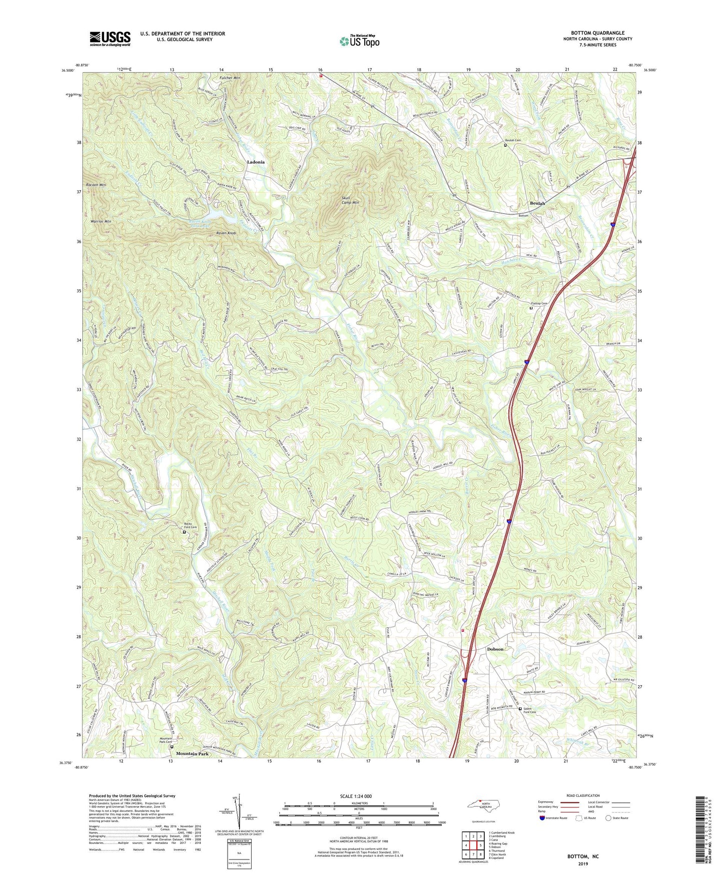
2022 topographic map quadrangle Bottom in the state of North Carolina. Scale: 1:24000. Based on the newly updated USGS 7.5' US Topo map series, this map is in the following counties: Surry. The map contains contour data, water features, and other items you are used to seeing on USGS maps, but also has updated roads and other features. This is the next generation of topographic maps. Printed on high-quality waterproof paper with UV fade-resistant inks.
Quads adjacent to this one:
West: Roaring Gap
Northwest: Cumberland Knob
North: Lambsburg
Northeast: Cana
East: Dobson
Southeast: Copeland
South: Elkin North
Southwest: Thurmond
This map covers the same area as the classic USGS quad with code o36080d7.
Contains the following named places: Beulah, Beulah Cemetery, Beulah Elementary School, Beulah Methodist Church, Blevins Store, Bottom Post Office, Bryan School, Burris Creek, Camp Raven Knob, Central Surry Volunteer Fire Department, Central View Church, Charity Hill Church, Christian Creek, Chryson Lake, Chryson Lake Dam, Cross Roads Baptist Church, Endicott Creek, Flat Branch, Flat Top Primitive Baptist Church, Flattop Cemetery, Hatchers Creek, Holy Cross Missionary Baptist Church, Jadesville, Kapps Mill, Ladonia, Ladonia Baptist Church, Little Endicott Creek, Little Vine Church, McMickle School, Mill Creek, Mitchell River Baptist Church, Mountain Park Cemetery, Muddy Fork, New Bethel Baptist Church, New Hope Church, New Life Baptist Church, Oak Grove, Oak Grove Baptist Church, Pine Branch, Potters Creek, Raven Knob, Raven Knob Park Lake, Raven Knob Park Lake Dam, Red Hill Creek, Rocky Ford Cemetery, Rocky Ford Missionary Baptist Church, Round Peak Tree Farm, Rusk, Sage Creek, Salem Fork Baptist Church, Salem Fork Cemetery, Salemfork, Skull Camp Fire and Rescue Department, Skull Camp Mountain, Township of Franklin, Warrior Mountain, Wood Fork, ZIP Code: 27017